Home > Maps > Canadian Topographic Maps > Canadian Topographic Block 072 > Canadian Topographic Block 072L

Canadian Topographic Maps - Block 072L


Use the following image to move to adjacent topo map indexes.

Sort By:
Page of 1
072L - MEDICINE HAT - Topographic Map 072L01 - MANY ISLAND LAKE - Topographic Map 072L02 - MEDICINE HAT - Topographic Map
072L03 - SUFFIELD - Topographic Map 072L04 - HAYS - Topographic Map 072L05 - TILLEY - Topographic Map
072L06 - ALDERSON - Topographic Map 072L07 - WATCHING HILL - Topographic Map 072L08 - HILDA - Topographic Map
072L09 - THE MIDDLE SAND HILLS - Topographic Map 072L10 - EASY COULEE - Topographic Map 072L11 - JENNER - Topographic Map
072L12 - BROOKS - Topographic Map 072L13 - WARDLOW - Topographic Map 072L14 - HOWIE - Topographic Map
072L15 - BUFFALO - Topographic Map 072L16 - BINDLOSS - Topographic Map AB072L - MEDICINE HAT - Topographic Map. The Alberta 1:250,000 scale paper topographic map series is part of the Alberta Environment & Parks Map Series. They are also referred to as topo or topographical maps is very useful for providing an overview of a


Back to the Block 072 Topographic Map Index.

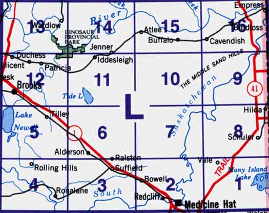
72L - Medicine Hat, 72L01 - Many Island Lake, 72L02 - Medicine Hat, 72L03 - Suffield, 72L04 - Hays, 72L05 - Tilley, 72L06 - Alderson, 72L07 - Watching Hill, 72L08 - Hilda, 72L09 - The Middle Sand Hills, 72L10 - Easy Coulee, 72L11 - Jenner, 72L12 - Brooks, 72L13 - Wardlow, 72L14 - Howie, 72L15 - Buffalo, 72L16 - Bindloss. One or more of these maps cover Dinosaur Provincial Park