Canadian Topographic Maps - North West Territory
1:250 000 and 1:50 000 scale NTS Maps
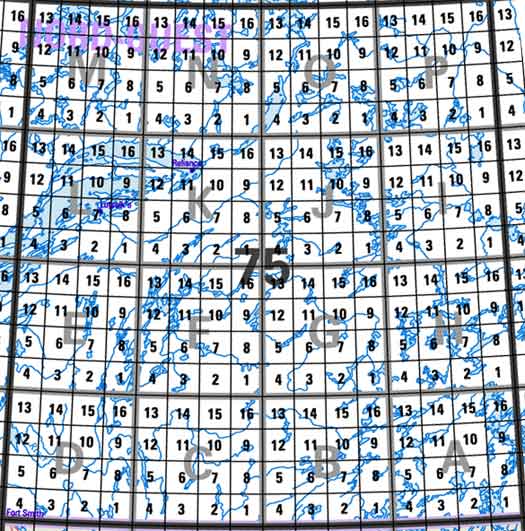
Click on the area below to retrieve topo maps from our database.
 Back to the North West Territory Topographical Maps Index.
Each lettered square on the topo map index above represents the following 1:250 000 scale topographical maps: 75A - Wholdaia Lake, 75B - Abitau Lake, 75C - Hill Island Lake, 75D - Fort Smith, 75E - Taltson Lake, 75F - Nonacho Lake, 75G - Mccann Lake, 75H - Rennie Lake, 75I - Beaverhill Lake, 75J - Lynx Lake, 75K - Reliance, 75L - Snowdrift, 75M - Mackay Lake, 75N - Walmsley Lake, 75O - Artillery Lake, 75P - Hanbury River.
|
|
|
