Home > Maps > Canadian Topographic Maps > Canadian Topographic Block 082 > Canadian Topographic Block 082P

Canadian Topographic Maps - Block 082P


Use the following image to move to adjacent topo map indexes.

Sort By:
Page of 1
082P - DRUMHELLER - Topographic Map 082P01 - FINNEGAN - Topographic Map 082P02 - HUSSAR - Topographic Map
082P03 - STRATHMORE - Topographic Map 082P04 - DALROY - Topographic Map 082P05 - IRRICANA - Topographic Map
082P06 - CARBON - Topographic Map 082P07 - DRUMHELLER - Topographic Map 082P08 - DOROTHY - Topographic Map
082P09 - CRAIGMYLE - Topographic Map 082P10 - MUNSON - Topographic Map 082P11 - THREE HILLS - Topographic Map
082P12 - LONEPINE CREEK - Topographic Map 082P13 - TORRINGTON - Topographic Map 082P14 - TROCHU - Topographic Map
082P15 - RUMSEY - Topographic Map 082P16 - FARRELL LAKE - Topographic Map AB082P - DRUMHELLER - Topographic Map. The Alberta 1:250,000 scale paper topographic map series is part of the Alberta Environment & Parks Map Series. They are also referred to as topo or topographical maps is very useful for providing an overview o


Back to the Block 082 Topographic Map Index.

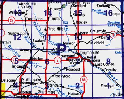
82P - Drumheller, 82P01 - Finnegan, 82P02 - Hussar, 82P03 - Strathmore, 82P04 - Dalroy, 82P05 - Irricana, 82P06 - Carbon, 82P07 - Drumheller, 82P08 - Dorothy, 82P09 - Craigmyle, 82P10 - Munson, 82P11 - Three Hills, 82P12 - Lonepine Creek, 82P13 - Torrington, 82P14 - Trochu, 82P15 - Rumsey, 82P16 - Farrell Lake. One or more of these maps cover Dry Island Provincial Park