Home > Maps > Canadian Topographic Maps > Canadian Topographic Block 084 > Canadian Topographic Block 084D

Canadian Topographic Maps - Block 084D


Use the following image to move to adjacent topo map indexes.

Sort By:
Page of 1
084D - CLEAR HILLS - Topographic Map 084D01 - FAIRVIEW - Topographic Map 084D02 - HINES CREEK - Topographic Map
084D03 - JOSEPHINE CREEK - Topographic Map 084D04 - CHERRY POINT - Topographic Map 084D05 - BOUNDARY LAKE - Topographic Map
084D06 - MANY ISLANDS - Topographic Map 084D07 - EUREKA RIVER - Topographic Map 084D08 - DEER HILL - Topographic Map
084D09 - SULPHUR LAKE - Topographic Map 084D10 - SOUTH WHITEMUD LAKE - Topographic Map 084D11 - WORSLEY - Topographic Map
084D12 - CLEAR PRAIRIE - Topographic Map 084D13 - BETTS CREEK - Topographic Map 084D14 - SQUARE CREEK - Topographic Map
084D15 - RAMBLING CREEK - Topographic Map 084D16 - CUB LAKES - Topographic Map AB084D - CLEAR HILLS - Topographic Map. The Alberta 1:250,000 scale paper topographic map series is part of the Alberta Environment & Parks Map Series. They are also referred to as topo or topographical maps is very useful for providing an overview of an


Back to the Block 084 Topographic Map Index.

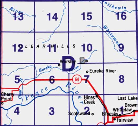
84D - Clear Hills, 84D01 - Fairview, 84D02 - Hines Creek, 84D03 - Josephine Creek, 84D04 - Cherry Point, 84D05 - Boundary Lake, 84D06 - Many Islands, 84D07 - Eureka River, 84D08 - Deer Hill, 84D09 - Sulphur Lake, 84D10 - South Whitemud Lake, 84D11 - Worsley, 84D12 - Clear Prairie, 84D13 - Betts Creek, 84D14 - Square Creek, 84D15 - Rambling Creek, 84D16 - Cub Lakes