Canadian Topographic Maps - Topo Block 052
1:250 000 and 1:50 000 scale NTS Maps
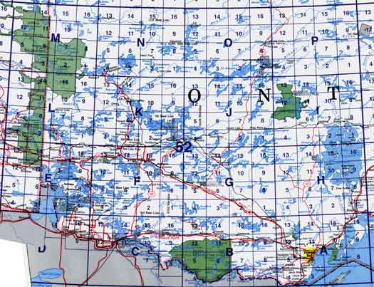
Click on an area of the map below to zoom in on each topo map index.
 Back to the Ontario Topographic Maps Index.
Back to the Manitoba Topographic Maps Index.
Each lettered square on the topo map index above represents the following 1:250 000 scale topographic maps: 52A - Thunder Bay, 52B - Quetico, 52C - International Falls, 52D - Roseau, 52E - Kenora, 52F - Dryden, 52G - Ignace, 52H - Nipigon, 52I - Armstrong, 52J - Sioux Lookout, 52K - Lac Seul, 52L - Pointe Du Bois, 52M - Carroll Lake, 52N - Trout Lake, 52O - Lake St Joseph, 52P - Miminiska Lake.
Click on the topo map index above to see more detailed maps and information about Ontario topographical maps, including Quetico topo maps, Lake of the Woods topo maps, Whiteshell topo maps, Sandbar Lake topo maps, Wabakimi topo maps, Nopiming topo maps, Wood Caribou topo maps, Atikai topo maps.
|
|
|
