Home > Maps > Canada Maps > Alberta County and Municipal District Maps
The Province of Alberta's land base outside of federal and provincial parks is split into different areas of land known as Counties, Municipal Districts, Special Areas or Improvement Districts. The majority of these different jurisdictions produce maps that show whether a particular quarter section is crown or government held land, leased crown land, crown land leased for grazing, or private land. These different lands are usually denoted by different colors. These maps are perfect if you want to find out who owns a specific quarter section, or if you are looking for current road information. County maps and Municipal maps mainly exist to show land ownership with each 1/4 section labeled with the owners name. Also shown by color coding are crown lands and leased lands.

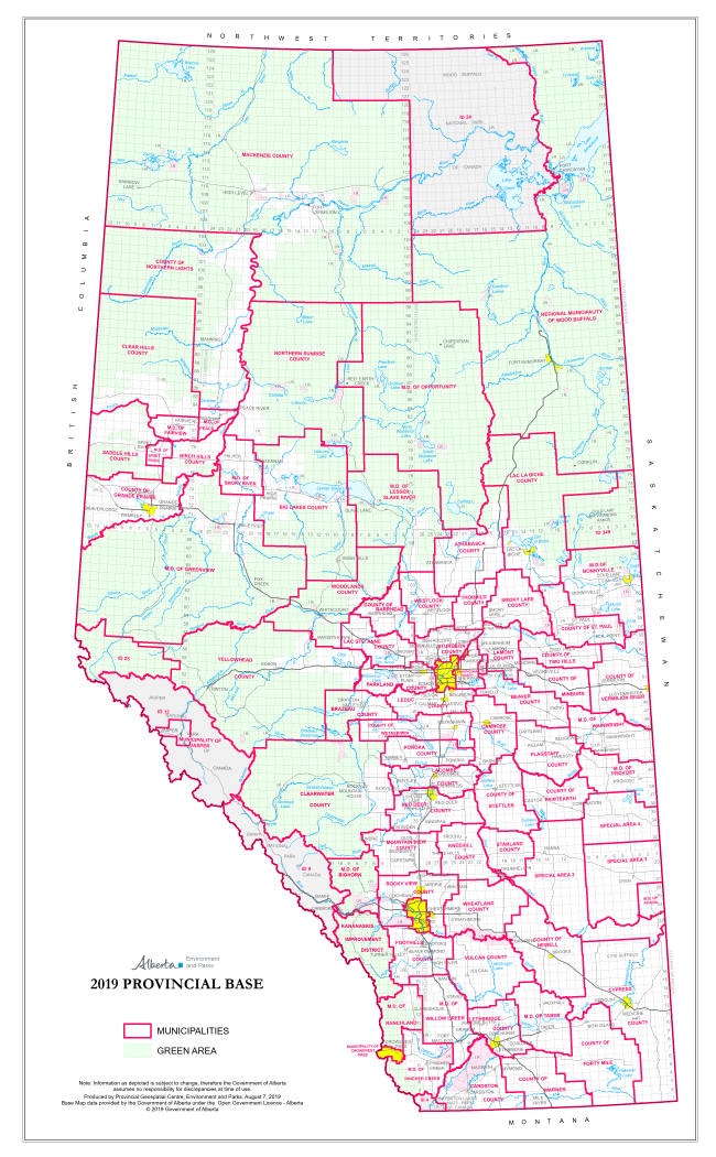
OVERVIEW MAP - Find your Land Owner Maps using the image below, then select your map(s) located underneath this image.


Sort By:
Page of 1
Athabasca County Landowner map - County 12. County and Municipal District (MD) maps show surface land ownership with each 1/4 section labeled with the owners name. Also shown by color are these land types - Crown (government), Freehold (private) and Crown Barrhead County Landowner map - County 11. County and Municipal District (MD) maps show surface land ownership with each 1/4 section labeled with the owners name. Also shown by color are these land types - Crown (government), Freehold (private) and Crown Beaver County Landownership map C9. Includes places such as Kinsella, Viking, Tofield and Holden. County and Municipal District (MD) maps show surface land ownership with each 1/4 section labeled with the owners name. Also shown by color are these land ty
Athabasca County Landowner map - County 12. County and Municipal District (MD) maps show surface land ownership with each 1/4 section labeled with the owners name. Also shown by color are these land types - Crown (government), Freehold (private) and Crown Leased lands. The maps show parks, cities, towns, villages, lakes, rivers and very current for road information, including Township and Range roads. Scale 1:90,000
Barrhead County Landowner map - County 11. County and Municipal District (MD) maps show surface land ownership with each 1/4 section labeled with the owners name. Also shown by color are these land types - Crown (government), Freehold (private) and Crown Leased lands. The maps show parks, cities, towns, villages, lakes, rivers and very current for road information, including Township and Range roads.
Beaver County Landownership map C9. Includes places such as Kinsella, Viking, Tofield and Holden. County and Municipal District (MD) maps show surface land ownership with each 1/4 section labeled with the owners name. Also shown by color are these land types - Crown (government), Freehold (private) and Crown Leased lands. The maps show parks, cities, towns, villages, lakes, rivers and very current for road information, including Township and Range roads.
Big Lakes Municipal District Landownership map - MD125. County and Municipal District (MD) maps show surface land ownership with each 1/4 section labeled with the owners name. Also shown by color are these land types - Crown (government), Freehold (privat Bighorn Municipal District Landowner map - MD 8. County and Municipal District (MD) maps show surface land ownership with each 1/4 section labeled with the owners name. Also shown by color are these land types - Crown (government), Freehold (private) and Birch Hills Municipal District Landowner map - MD 19. County and Municipal District (MD) maps show surface land ownership with each 1/4 section labeled with the owners name. Also shown by color are these land types - Crown (government), Freehold (private)
Big Lakes Municipal District Landownership map - MD125. Comes in two sheets.There are two map sheets that comprise this Municipal District (MD). MD maps show surface land ownership with each 1/4 section labeled with the owners name. Also shown by color are these land types - Crown (government), Freehold (private) and Crown Leased lands. The maps show parks, cities, towns, villages, lakes, rivers and very current for road information, including Township and Range roads. Bighorn Municipal District Landowner map - MD 8. County and Municipal District (MD) maps show surface land ownership with each 1/4 section labeled with the owners name. Also shown by color are these land types - Crown (government), Freehold (private) and Crown Leased lands. The maps show parks, cities, towns, villages, lakes, rivers and very current for road information, including Township and Range roads.

Birch Hills Municipal District Landowner map - MD 19. County and Municipal District (MD) maps show surface land ownership with each 1/4 section labeled with the owners name. Also shown by color are these land types - Crown (government), Freehold (private) and Crown Leased lands. The maps show parks, cities, towns, villages, lakes, rivers and very current for road information, including Township and Range roads.
Bonnyville Municipal District Landowner map - MD 87. Major city includes Cold Lake. County and Municipal District (MD) maps show surface land ownership with each 1/4 section labeled with the owners name. Also shown by color are these land types - Crown Bow Valley NW Kananaskis WMU Map.  The maps shows the boundary for Kananaskis Country, the Public Land Use Zones, crown land, private or freehold land, park boundaries, wildlife corridors and sanctuaries, camping spots, trailheads, roads, atv trails, hiki Camrose County Landowner map - County 22. County and Municipal District (MD) maps show surface land ownership with each 1/4 section labeled with the owners name. Also shown by color are these land types - Crown (government), Freehold (private) and Crown L
Bonnyville Municipal District Landowner map - MD 87. Major city includes Cold Lake. County and Municipal District (MD) maps show surface land ownership with each 1/4 section labeled with the owners name. Also shown by color are these land types - Crown (government), Freehold (private) and Crown Leased lands. The maps show parks, cities, towns, villages, lakes, rivers and very current for road information, including Township and Range roads.
Bow Valley NW Kananaskis WMU Map. The maps shows the boundary for Kananaskis Country, the Public Land Use Zones, crown land, private or freehold land, park boundaries, wildlife corridors and sanctuaries, camping spots, trailheads, roads, atv trails, hiking trails, forestry roads, rivers, lakes, and other waterways, cities, towns, villages, airports, political boundaries, latitude and longitude grids. This Alberta provincial base map also depicts wildlife management units (WMU's) 314, 406, 410, 412, 648 and 794 and the no hunting zones.
Camrose County Landowner map - County 22. County and Municipal District (MD) maps show surface land ownership with each 1/4 section labeled with the owners name. Also shown by color are these land types - Crown (government), Freehold (private) and Crown Leased lands. The maps show parks, cities, towns, villages, lakes, rivers and very current for road information, including Township and Range roads.
Cardston Municipal District Landowner map - MD 6. County and Municipal District (MD) maps show surface land ownership with each 1/4 section labeled with the owners name. Also shown by color are these land types - Crown (government), Freehold (private) and Clear Hills South Municipal District Landowner Map - MD 21. County and Municipal District (MD) maps show surface land ownership with each 1/4 section labeled with the owners name. Also shown by color are these land types - Crown (government), Freehold Clearwater North Landownership Map - MD 99. County and Municipal District (MD) maps show surface land ownership with each 1/4 section labeled with the owners name. Also shown by color are these land types - Crown (government), Freehold (private) and Crown
Cardston Municipal District Landowner map - MD 6. County and Municipal District (MD) maps show surface land ownership with each 1/4 section labeled with the owners name. Also shown by color are these land types - Crown (government), Freehold (private) and Crown Leased lands. The maps show parks, cities, towns, villages, lakes, rivers and very current for road information, including Township and Range roads.

Clear Hills South Municipal District Landowner Map - MD 21. County and Municipal District (MD) maps show surface land ownership with each 1/4 section labeled with the owners name. Also shown by color are these land types - Crown (government), Freehold (private) and Crown Leased lands. The maps show parks, cities, towns, villages, lakes, rivers and very current for road information, including Township and Range roads.

Clearwater North Landownership Map - MD 99. County and Municipal District (MD) maps show surface land ownership with each 1/4 section labeled with the owners name. Also shown by color are these land types - Crown (government), Freehold (private) and Crown Leased lands. The maps show parks, cities, towns, villages, lakes, rivers and very current for road information, including Township and Range roads.
Clearwater South Landownership Map - MD 99. County and Municipal District (MD) maps show surface land ownership with each 1/4 section labeled with the owners name. Also shown by color are these land types - Crown (government), Freehold (private) and Crown Crowsnest Pass Landowner map - M1. County and Municipal District (MD) maps show surface land ownership with each 1/4 section labeled with the owners name. Also shown by color are these land types - Crown (government), Freehold (private) and Crown Leased Cypress Municipal District 1 Atlas
Clearwater South Landownership Map - MD 99. County and Municipal District (MD) maps show surface land ownership with each 1/4 section labeled with the owners name. Also shown by color are these land types - Crown (government), Freehold (private) and Crown Leased lands. The maps show parks, cities, towns, villages, lakes, rivers and very current for road information, including Township and Range roads. Crowsnest Pass Landowner map - M1. County and Municipal District (MD) maps show surface land ownership with each 1/4 section labeled with the owners name. Also shown by color are these land types - Crown (government), Freehold (private) and Crown Leased lands. The maps show parks, cities, towns, villages, lakes, rivers and very current for road information, including Township and Range roads. County and Municipal maps mainly exist to show land ownership with each 1/4 section labeled with the owners name. Also shown by color coding is the crown lands and leased lands. The maps are also very current for road information.  11" x 14" Coil bound atlas.
Fairview Municipal District Landowner map - MD 136. County and Municipal District (MD) maps show surface land ownership with each 1/4 section labeled with the owners name. Also shown by color are these land types - Crown (government), Freehold (private) a Flagstaff County Landowner map C29. County and Municipal District (MD) maps show surface land ownership with each 1/4 section labeled with the owners name. Also shown by color are these land types - Crown (government), Freehold (private) and Crown Leased Foothills County Landowner Map - MD 31. County and Municipal District (MD) maps show surface land ownership with each 1/4 section labeled with the owners name. Also shown by color are these land types - Crown (government), Freehold (private) and Crown Lea
Fairview Municipal District Landowner map - MD 136. County and Municipal District (MD) maps show surface land ownership with each 1/4 section labeled with the owners name. Also shown by color are these land types - Crown (government), Freehold (private) and Crown Leased lands. The maps show parks, cities, towns, villages, lakes, rivers and very current for road information, including Township and Range roads.
Flagstaff County Landowner Map C29. County and Municipal District (MD) maps show surface land ownership with each 1/4 section labeled with the owners name. Also shown by color are these land types - Crown (government), Freehold (private) and Crown Leased lands. The maps show parks, cities, towns, villages, lakes, rivers and very current for road information, including Township and Range roads.
Foothills County Landowner Map - MD 31. County and Municipal District (MD) maps show surface land ownership with each 1/4 section labeled with the owners name. Also shown by color are these land types - Crown (government), Freehold (private) and Crown Leased lands. The maps show parks, cities, towns, villages, lakes, rivers and very current for road information, including Township and Range roads.

Forty Mile County Landownership map - C8. County and Municipal District (MD) maps show surface land ownership with each 1/4 section labeled with the owners name. Also shown by color are these land types - Crown (government), Freehold (private) and Crown L Grande Prairie Landowner Map - County 1. County and Municipal District (MD) maps show surface land ownership with each 1/4 section labeled with the owners name. Also shown by color are these land types - Crown (government), Freehold (private) and Crown Le Greenview MD 16 Landowner map - Sheet 1 Valleyview. County and Municipal District (MD) maps show surface land ownership with each 1/4 section labeled with the owners name. Also shown by color are these land types - Crown (government), Freehold (private)
Forty Mile County Landownership map - C8. County and Municipal District (MD) maps show surface land ownership with each 1/4 section labeled with the owners name. Also shown by color are these land types - Crown (government), Freehold (private) and Crown Leased lands. The maps show parks, cities, towns, villages, lakes, rivers and very current for road information, including Township and Range roads. Grande Prairie Landowner Map - County 1. County and Municipal District (MD) maps show surface land ownership with each 1/4 section labeled with the owners name. Also shown by color are these land types - Crown (government), Freehold (private) and Crown Leased lands. The maps show parks, cities, towns, villages, lakes, rivers and very current for road information, including Township and Range roads. Greenview MD16 Landowner map - Sheet 1 Valleyview. County and Municipal District (MD) maps show surface land ownership with each 1/4 section labeled with the owners name. Also shown by color are these land types - Crown (government), Freehold (private) and Crown Leased lands. The maps show parks, cities, towns, villages, lakes, rivers and very current for road information, including Township and Range roads.
Greenview MD 16 Landowner map - Sheet 2 Debolt. County and Municipal District (MD) maps show surface land ownership with each 1/4 section labeled with the owners name. Also shown by color are these land types - Crown (government), Freehold (private) Greenview MD 16 Landowner map - Sheet 3 Grovedale. County and Municipal District (MD) maps show surface land ownership with each 1/4 section labeled with the owners name. Also shown by color are these land types - Crown (government), Freehold (private) Greenview MD 16 Landowner map - Sheet 4 Grande Cache. County and Municipal District (MD) maps show surface land ownership with each 1/4 section labeled with the owners name. Also shown by color are these land types - Crown (government), Freehold (private)
Greenview MD 16 Landowner map - Sheet 2 Debolt. County and Municipal District (MD) maps show surface land ownership with each 1/4 section labeled with the owners name. Also shown by color are these land types - Crown (government), Freehold (private) and Crown Leased lands. The maps show parks, cities, towns, villages, lakes, rivers and very current for road information, including Township and Range roads. Greenview MD 16 Landowner map - Sheet 3 Grovedale. County and Municipal District (MD) maps show surface land ownership with each 1/4 section labeled with the owners name. Also shown by color are these land types - Crown (government), Freehold (private) and Crown Leased lands. The maps show parks, cities, towns, villages, lakes, rivers and very current for road information, including Township and Range roads. Greenview MD 16 Landowner map - Sheet 4 Grande Cache. County and Municipal District (MD) maps show surface land ownership with each 1/4 section labeled with the owners name. Also shown by color are these land types - Crown (government), Freehold (private) and Crown Leased lands. The maps show parks, cities, towns, villages, lakes, rivers and very current for road information, including Township and Range roads.
Greenview MD 16 Landowner map - Sheet 5. County and Municipal District (MD) maps show surface land ownership with each 1/4 section labeled with the owners name. Also shown by color are these land types - Crown (government), Freehold (private) and Crown Highwood & Plateau Mountain South Kananaskis WMU Map. The maps shows the boundary for Kananaskis Country, the Public Land Use Zones, crown land, private or freehold land, park boundaries, wildlife corridors and sanctuaries, camping spots, trailheads, road Kneehill Municipal District Landowner map MD48. County and Municipal District (MD) maps show surface land ownership with each 1/4 section labeled with the owners name. Also shown by color are these land types - Crown (government), Freehold (private) and C
Greenview MD 16 Landowner map - Sheet 5. County and Municipal District (MD) maps show surface land ownership with each 1/4 section labeled with the owners name. Also shown by color are these land types - Crown (government), Freehold (private) and Crown Leased lands. The maps show parks, cities, towns, villages, lakes, rivers and very current for road information, including Township and Range roads.
Highwood & Plateau Mountain South Kananaskis WMU Map. The maps shows the boundary for Kananaskis Country, the Public Land Use Zones, crown land, private or freehold land, park boundaries, wildlife corridors and sanctuaries, camping spots, trailheads, roads, ATV trails, hiking trails, forestry roads, rivers, lakes, and other waterways, cities, towns, villages, airports, political boundaries, latitude and longitude grids. This Alberta provincial base map also depicts wildlife management units (WMU's) 308, 310, 312, 402, 404 and 406, plus the no hunting zones.
Kneehill Municipal District Landowner map MD48. County and Municipal District (MD) maps show surface land ownership with each 1/4 section labeled with the owners name. Also shown by color are these land types - Crown (government), Freehold (private) and Crown Leased lands. The maps show parks, cities, towns, villages, lakes, rivers and very current for road information, including Township and Range roads.
Lac La Biche County 99 North East Lac La Biche landowner map - County 99 South and Central. County and Municipal District (MD) maps show surface land ownership with each 1/4 section labeled with the owners name. Also shown by color are these land types - Crown (government), Freehold (priv Lac St. Anne Landowner Map - County 28. County and Municipal District (MD) maps show surface land ownership with each 1/4 section labeled with the owners name. Also shown by color are these land types - Crown (government), Freehold (private) and Crown Lea
County and Municipal maps mainly exist to show land ownership with each 1/4 section labeled with the owners name. Also shown by color coding is the crown lands and leased lands. The maps are also very current for road information. Lac La Biche landowner map - County 99 South and Central. County and Municipal District (MD) maps show surface land ownership with each 1/4 section labeled with the owners name. Also shown by color are these land types - Crown (government), Freehold (private) and Crown Leased lands. The maps show parks, cities, towns, villages, lakes, rivers and very current for road information, including Township and Range roads. Lac St. Anne Landowner Map - County 28. County and Municipal District (MD) maps show surface land ownership with each 1/4 section labeled with the owners name. Also shown by color are these land types - Crown (government), Freehold (private) and Crown Leased lands. The maps show parks, cities, towns, villages, lakes, rivers and very current for road information, including Township and Range roads.
Lacombe County Landowner map - County 14. County and Municipal District (MD) maps show surface land ownership with each 1/4 section labeled with the owners name. Also shown by color are these land types - Crown (government), Freehold (private) and Crown L Lamont County 30 Landownership Map. County and Municipal District (MD) maps show surface land ownership with each 1/4 section labeled with the owners name. Also shown by color are these land types - Crown (government), Freehold (private) and Crown Leased Leduc County Landowner map - County 25. County and Municipal District (MD) maps show surface land ownership with each 1/4 section labeled with the owners name. Also shown by color are these land types - Crown (government), Freehold (private) and Crown Lea
Lacombe County Landowner map - County 14. County and Municipal District (MD) maps show surface land ownership with each 1/4 section labeled with the owners name. Also shown by color are these land types - Crown (government), Freehold (private) and Crown Leased lands. The maps show parks, cities, towns, villages, lakes, rivers and very current for road information, including Township and Range roads.
Lamont County 30 Landownership Map. County and Municipal District (MD) maps show surface land ownership with each 1/4 section labeled with the owners name. Also shown by color are these land types - Crown (government), Freehold (private) and Crown Leased lands. The maps show parks, cities, towns, villages, lakes, rivers and very current for road information, including Township and Range roads.
Leduc County Landowner map - County 25. County and Municipal District (MD) maps show surface land ownership with each 1/4 section labeled with the owners name. Also shown by color are these land types - Crown (government), Freehold (private) and Crown Leased lands. The maps show parks, cities, towns, villages, lakes, rivers and very current for road information, including Township and Range roads.
Lesser Slave River Municipal District Landownership map - MD124. County and Municipal District (MD) maps show surface land ownership with each 1/4 section labeled with the owners name. Also shown by color are these land types - Crown (government), Freehol Lethbridge County Landowner map - County 26. County and Municipal District (MD) maps show surface land ownership with each 1/4 section labeled with the owners name. Also shown by color are these land types - Crown (government), Freehold (private) and Crow Mackenzie Municipal District Landownership map - MD23. County and Municipal District (MD) maps show surface land ownership with each 1/4 section labeled with the owners name. Also shown by color are these land types - Crown (government), Freehold (private
Lesser Slave River Municipal District Landownership map - MD124. County and Municipal District (MD) maps show surface land ownership with each 1/4 section labeled with the owners name. Also shown by color are these land types - Crown (government), Freehold (private) and Crown Leased lands. The maps show parks, cities, towns, villages, lakes, rivers and very current for road information, including Township and Range roads. A must-have for hunterss, developers, landowners and much more. Lethbridge County Landowner map - County 26. County and Municipal District (MD) maps show surface land ownership with each 1/4 section labeled with the owners name. Also shown by color are these land types - Crown (government), Freehold (private) and Crown Leased lands. The maps show parks, cities, towns, villages, lakes, rivers and very current for road information, including Township and Range roads.

Mackenzie Municipal District Landownership map - MD23. County and Municipal District (MD) maps show surface land ownership with each 1/4 section labeled with the owners name. Also shown by color are these land types - Crown (government), Freehold (private) and Crown Leased lands. The maps show parks, cities, towns, villages, lakes, rivers and very current for road information, including Township and Range roads.
Minburn County Landowner map C27. County and Municipal District (MD) maps show surface land ownership with each 1/4 section labeled with the owners name. Also shown by color are these land types - Crown (government), Freehold (private) and Crown Leased la Mountain View County Landowner Map. County and Municipal District (MD) maps show surface land ownership with each 1/4 section labeled with the owners name. Also shown by color are these land types - Crown (government), Freehold (private) and Crown Leased Newell County Landowner map - County 4. County and Municipal District (MD) maps show surface land ownership with each 1/4 section labeled with the owners name. Also shown by color are these land types - Crown (government), Freehold (private) and Crown Lea
Minburn County Landowner map C27. County and Municipal District (MD) maps show surface land ownership with each 1/4 section labeled with the owners name. Also shown by color are these land types - Crown (government), Freehold (private) and Crown Leased lands. The maps show parks, cities, towns, villages, lakes, rivers and very current for road information, including Township and Range roads.
Mountain View County Landowner Map. County and Municipal District (MD) maps show surface land ownership with each 1/4 section labeled with the owners name. Also shown by color are these land types - Crown (government), Freehold (private) and Crown Leased lands. The maps show parks, cities, towns, villages, lakes, rivers and very current for road information, including Township and Range roads. Newell County Landowner map - County 4. County and Municipal District (MD) maps show surface land ownership with each 1/4 section labeled with the owners name. Also shown by color are these land types - Crown (government), Freehold (private) and Crown Leased lands. The maps show parks, cities, towns, villages, lakes, rivers and very current for road information, including Township and Range roads.
Northern Lights Municipal District 22 North Northern Lights Municipal District 22 South Northern Sunrise Municipal District Landownership map MD 131. County and Municipal District (MD) maps show surface land ownership with each 1/4 section labeled with the owners name. Also shown by color are these land types - Crown (government), Freehold
County and Municipal maps mainly exist to show land ownership with each 1/4 section labeled with the owners name. Also shown by color coding is the crown lands and leased lands. The maps are also very current for road information. County and Municipal maps mainly exist to show land ownership with each 1/4 section labeled with the owners name. Also shown by color coding is the crown lands and leased lands. The maps are also very current for road information. Northern Sunrise Municipal District Landownership map MD 131. County and Municipal District (MD) maps show surface land ownership with each 1/4 section labeled with the owners name. Also shown by color are these land types - Crown (government), Freehold (private) and Crown Leased lands. The maps show parks, cities, towns, villages, lakes, rivers and very current for road information, including Township and Range roads.
Paintearth County Landowner map - County 18. County and Municipal District (MD) maps show surface land ownership with each 1/4 section labeled with the owners name. Also shown by color are these land types - Crown (government), Freehold (private) and Crow Parkland County Landownership map - C31. County and Municipal District (MD) maps show surface land ownership with each 1/4 section labeled with the owners name. Also shown by color are these land types - Crown (government), Freehold (private) and Crown Le Peace Municipal District 135 Landownership map. Includes the towns of Grimshaw and Peace River, along with the First Nation of Duncan. County and Municipal District (MD) maps show surface land ownership with each 1/4 section labeled with the owners name.
Paintearth County Landowner Map - County 18. County and Municipal District (MD) maps show surface land ownership with each 1/4 section labeled with the owners name. Also shown by color are these land types - Crown (government), Freehold (private) and Crown Leased lands. The maps show parks, cities, towns, villages, lakes, rivers and very current for road information, including Township and Range roads.
Parkland County Landownership Map - C31. County and Municipal District (MD) maps show surface land ownership with each 1/4 section labeled with the owners name. Also shown by color are these land types - Crown (government), Freehold (private) and Crown Leased lands. The maps show parks, cities, towns, villages, lakes, rivers and very current for road information, including Township and Range roads.

Peace Municipal District 135 Landownership map. Includes the towns of Grimshaw and Peace River, along with the First Nation of Duncan. County and Municipal District (MD) maps show surface land ownership with each 1/4 section labeled with the owners name. Also shown by color are these land types - Crown (government), Freehold (private) and Crown Leased lands. The maps show parks, cities, towns, villages, lakes, rivers and very current for road information, including Township and Range roads.
Peter Lougheed Provincial Park SE Kananaskis WMU Map. The maps shows the boundary for Kananaskis Country, the Public Land Use Zones, crown land, private or freehold land, park boundaries, wildlife corridors and sanctuaries, camping spots, trailheads, road Pincher Creek Landowner Map - MD 9. County and Municipal District (MD) maps show surface land ownership with each 1/4 section labeled with the owners name. Also shown by color are these land types - Crown (government), Freehold (private) and Crown Leased Ponoka County Landowner map - County 3. County and Municipal District (MD) maps show surface land ownership with each 1/4 section labeled with the owners name. Also shown by color are these land types - Crown (government), Freehold (private) and Crown Lea
Peter Lougheed Provincial Park SE Kananaskis WMU Map. The maps shows the boundary for Kananaskis Country, the Public Land Use Zones, crown land, private or freehold land, park boundaries, wildlife corridors and sanctuaries, camping spots, trailheads, roads, ATV trails, hiking trails, forestry roads, rivers, lakes, and other waterways, cities, towns, villages, airports, political boundaries, latitude and longitude grids. This Alberta provincial base map also depicts wildlife management units (WMU's) 406, 408, 648 and 794, plus the no hunting zones.
Pincher Creek Landowner Map - MD 9. County and Municipal District (MD) maps show surface land ownership with each 1/4 section labeled with the owners name. Also shown by color are these land types - Crown (government), Freehold (private) and Crown Leased lands. The maps show parks, cities, towns, villages, lakes, rivers and very current for road information, including Township and Range roads. Ponoka County Landowner Map - County 3. County and Municipal District (MD) maps show surface land ownership with each 1/4 section labeled with the owners name. Also shown by color are these land types - Crown (government), Freehold (private) and Crown Leased lands. The maps show parks, cities, towns, villages, lakes, rivers and very current for road information, including Township and Range roads.
Provost Municipal District Landownership Map. Current County and Municipal maps mainly exist to show land ownership with each 1/4 section labeled with the owners name. Also shown by color coding is the crown lands and leased lands. The maps are also very Ranchlands Municipal District Landowner map - MD 66. County and Municipal District (MD) maps show surface land ownership with each 1/4 section labeled with the owners name. Also shown by color are these land types - Crown (government), Freehold (private) Red Deer County Landowner map - County 23. County and Municipal District (MD) maps show surface land ownership with each 1/4 section labeled with the owners name. Also shown by color are these land types - Crown (government), Freehold (private) and Crown
Provost Municipal District Landownership Map. Current County and Municipal maps mainly exist to show land ownership with each 1/4 section labeled with the owners name. Also shown by color coding is the crown lands and leased lands. The maps are also very current for road information. Ranchlands Municipal District Landowner map - MD 66. County and Municipal District (MD) maps show surface land ownership with each 1/4 section labeled with the owners name. Also shown by color are these land types - Crown (government), Freehold (private) and Crown Leased lands. The maps show parks, cities, towns, villages, lakes, rivers and very current for road information, including Township and Range roads.
Red Deer County Landowner map - County 23. County and Municipal District (MD) maps show surface land ownership with each 1/4 section labeled with the owners name. Also shown by color are these land types - Crown (government), Freehold (private) and Crown Leased lands. The maps show parks, cities, towns, villages, lakes, rivers and very current for road information, including Township and Range roads.
Rockyview County Landowner map - Municipal District 44. County and Municipal maps mainly exist to show land ownership with each quarter section labeled with the owners name. Also shown by color coding is the crown lands and leased lands. The maps are also Saddle Hills Municipal District Landownership map  - MD20. County and Municipal District (MD) maps show surface land ownership with each 1/4 section labeled with the owners name. Also shown by color are these land types - Crown (government), Freehold (pri Sheep River & Highwood SE Kananaskis WMU Map. The maps shows the boundary for Kananaskis Country, the Public Land Use Zones, crown land, private or freehold land, park boundaries, wildlife corridors and sanctuaries, camping spots, trailheads, roads, ATV t
Rockyview County Landowner map - Municipal District 44. County and Municipal maps mainly exist to show land ownership with each quarter section labeled with the owners name. Also shown by color coding is the crown lands and leased lands. The maps are also very current for road information. Perfect to know who owns the land near you. Perfect for investors, realtors, planners, developers and speculators to name a few.
Saddle Hills Municipal District Landownership map - MD20. County and Municipal District (MD) maps show surface land ownership with each 1/4 section labeled with the owners name. Also shown by color are these land types - Crown (government), Freehold (private) and Crown Leased lands. The maps show parks, cities, towns, villages, lakes, rivers and very current for road information, including Township and Range roads.
Sheep River & Highwood SE Kananaskis WMU Map. The maps shows the boundary for Kananaskis Country, the Public Land Use Zones, crown land, private or freehold land, park boundaries, wildlife corridors and sanctuaries, camping spots, trailheads, roads, ATV trails, hiking trails, forestry roads, rivers, lakes, and other waterways, cities, towns, villages, airports, political boundaries, latitude and longitude grids. This Alberta provincial base map also depicts wildlife management units (WMU's) 310, 312, 404 and 406, plus the no hunting zones.
Sibbald & Elbow NE Kananaskis WMU Map. The maps shows the boundary for Kananaskis Country, the Public Land Use Zones, crown land, private or freehold land, park boundaries, wildlife corridors and sanctuaries, camping spots, trailheads, roads, atv trails, Smoky Lake Land Ownership Map - County 13. County and Municipal District (MD) maps show surface land ownership with each 1/4 section labeled with the owners name. Also shown by color are these land types - Crown (government), Freehold (private) and Crown Smoky River Municipal District Landownership map MD130. County and Municipal District (MD) maps show surface land ownership with each 1/4 section labeled with the owners name. Also shown by color are these land types - Crown (government), Freehold (privat
Sibbald & Elbow NE Kananaskis WMU Map. The maps shows the boundary for Kananaskis Country, the Public Land Use Zones, crown land, private or freehold land, park boundaries, wildlife corridors and sanctuaries, camping spots, trailheads, roads, atv trails, hiking trails, forestry roads, rivers, lakes, and other waterways, cities, towns, villages, airports, political boundaries, latitude and longitude grids. This Alberta provincial base map also depicts wildlife management units (WMU's) 312, 314, 406 and 408 and the no hunting zones. Also shows McLean Creek and Tsuu Tina First Nation.
Smoky Lake Land Ownership Map - County 13. County and Municipal District (MD) maps show surface land ownership with each 1/4 section labeled with the owners name. Also shown by color are these land types - Crown (government), Freehold (private) and Crown Leased lands. The maps show parks, cities, towns, villages, lakes, rivers and very current for road information, including Township and Range roads.
Smoky River Municipal District Landownership map MD130. County and Municipal District (MD) maps show surface land ownership with each 1/4 section labeled with the owners name. Also shown by color are these land types - Crown (government), Freehold (private) and Crown Leased lands. The maps show parks, cities, towns, villages, lakes, rivers and very current for road information, including Township and Range roads.
Special Areas and Municipal District of Acadia Spirit River Municipal District 133 St. Paul County Landowner map - County 19. County and Municipal District (MD) maps show surface land ownership with each 1/4 section labeled with the owners name. Also shown by color are these land types - Crown (government), Freehold (private) and Crown
The separate Special Areas east and west maps have been discontinued and now come in coilbound book format. This book includes all of the Special Areas plus MD 34 Acadia. This book shows landowner names by quarter section.   Shows Wildlife Management Unit Boundaries.
County and Municipal District (MD) maps show surface land ownership with each 1/4 section labeled with the owners name. Also shown by color are these land types - Crown (government), Freehold (private) and Crown Leased lands. The maps show parks, cities, towns, villages, lakes, rivers and very current for road information, including Township and Range roads.
St. Paul County Landowner map - County 19. County and Municipal District (MD) maps show surface land ownership with each 1/4 section labeled with the owners name. Also shown by color are these land types - Crown (government), Freehold (private) and Crown Leased lands. The maps show parks, cities, towns, villages, lakes, rivers and very current for road information, including Township and Range roads.
Starland Landowner Map - Municipal District 47. County and Municipal maps mainly exist to show land ownership with each 1/4 section labeled with the owners name. Also shown by color coding is the crown lands and leased lands. The maps are also very curren Stettler County Landowner map. County 6. County and Municipal District (MD) maps show surface land ownership with each 1/4 section labeled with the owners name. Also shown by color are these land types, Crown (government), Freehold (private) and Crown La Strathcona County Landowner Map - County 20. County and Municipal District (MD) maps show surface land ownership with each 1/4 section labeled with the owners name. Also shown by color are these land types - Crown (government), Freehold (private) and Crow
Starland Landowner Map - Municipal District 47. County and Municipal maps mainly exist to show land ownership with each 1/4 section labeled with the owners name. Also shown by color coding is the crown lands and leased lands. The maps are also very current for road information. Stettler County Landowner map - County 6. County and Municipal District (MD) maps show surface land ownership with each 1/4 section labeled with the owners name. Also shown by color are these land types - Crown (government), Freehold (private) and Crown Leased lands. The maps show parks, cities, towns, villages, lakes, rivers and very current for road information, including Township and Range roads.

Strathcona County Landowner Map - County 20. County and Municipal District (MD) maps show surface land ownership with each 1/4 section labeled with the owners name. Also shown by color are these land types - Crown (government), Freehold (private) and Crown Leased lands. The maps show parks, cities, towns, villages, lakes, rivers and very current for road information, including Township and Range roads.

Source: Strathcona County (copyright)
Year: 2021
Significant efforts have been made to keep the map current, accurate, useful and affordable. Copying or reproducing this map in any fashion is strictly prohibited.
Sturgeon Landowner Map - Municipal District 90. County and Municipal District (MD) maps show surface land ownership with each 1/4 section labeled with the owners name. Also shown by color are these land types - Crown (government), Freehold (private) and C Taber Municipal District Landownership Map. County and Municipal District (MD) maps show surface land ownership with each 1/4 section labeled with the owners name. Also shown by color are these land types - Crown (government), Freehold (private) and Crown Thorhild County Landowner map - C7. County and Municipal District (MD) maps show surface land ownership with each 1/4 section labeled with the owners name. Also shown by color are these land types - Crown (government), Freehold (private) and Crown Leased
Sturgeon Landowner Map - Municipal District 90. County and Municipal District (MD) maps show surface land ownership with each 1/4 section labeled with the owners name. Also shown by color are these land types - Crown (government), Freehold (private) and Crown Leased lands. The maps show parks, cities, towns, villages, lakes, rivers and very current for road information, including Township and Range roads.
Taber Municipal District Landownership Map. County and Municipal District (MD) maps show surface land ownership with each 1/4 section labeled with the owners name. Also shown by color are these land types - Crown (government), Freehold (private) and Crown Leased lands. The maps show parks, cities, towns, villages, lakes, rivers and very current for road information, including Township and Range roads.

Thorhild County Landowner map - C7. County and Municipal District (MD) maps show surface land ownership with each 1/4 section labeled with the owners name. Also shown by color are these land types - Crown (government), Freehold (private) and Crown Leased lands. The maps show parks, cities, towns, villages, lakes, rivers and very current for road information, including Township and Range roads.
Two Hills County Landowner map - C21. County and Municipal District (MD) maps show surface land ownership with each 1/4 section labeled with the owners name. Also shown by color are these land types - Crown (government), Freehold (private) and Crown Lease Vermilion River County Landowner map. County and Municipal District (MD) maps show surface land ownership with each 1/4 section labeled with the owners name. Also shown by color are these land types - Crown (government), Freehold (private) and Crown Lease Vulcan County 2 Landownership Map. County and Municipal District (MD) maps show surface land ownership with each 1/4 section labeled with the owners name. Also shown by color are these land types - Crown (government), Freehold (private) and Crown Leased l
Two Hills County Landowner map - C21. County and Municipal District (MD) maps show surface land ownership with each 1/4 section labeled with the owners name. Also shown by color are these land types - Crown (government), Freehold (private) and Crown Leased lands. The maps show parks, cities, towns, villages, lakes, rivers and very current for road information, including Township and Range roads.
Map showing Vermilion River County Landowners.County and Municipal District (MD) maps show surface land ownership with each 1/4 section labeled with the owners name. Also shown by color are these land types - Crown (government), Freehold (private) and Crown Leased lands. The maps show parks, cities, towns, villages, lakes, rivers and very current for road information, including Township and Range roads.
Vulcan County 2 Landownership Map. County and Municipal District (MD) maps show surface land ownership with each 1/4 section labeled with the owners name. Also shown by color are these land types - Crown (government), Freehold (private) and Crown Leased lands. The maps show parks, cities, towns, villages, lakes, rivers and very current for road information, including Township and Range roads.
Wainwright Municipal District Landowner map - MD 61. County and Municipal District (MD) maps show surface land ownership with each 1/4 section labeled with the owners name. Also shown by color are these land types - Crown (government), Freehold (private) Warner County Landowner map - County 5. County and Municipal District (MD) maps show surface land ownership with each 1/4 section labeled with the owners name. Also shown by color are these land types - Crown (government), Freehold (private) and Crown Lea Westlock County Landowner Map - County 92. County and Municipal District (MD) maps show surface land ownership with each 1/4 section labeled with the owners name. Also shown by color are these land types - Crown (government), Freehold (private) and Crown
Wainwright Municipal District Landowner Map - MD 61. County and Municipal District (MD) maps show surface land ownership with each 1/4 section labeled with the owners name. Also shown by color are these land types - Crown (government), Freehold (private) and Crown Leased lands. The maps show parks, cities, towns, villages, lakes, rivers and very current for road information, including Township and Range roads. Warner County Landowner map - County 5. County and Municipal District (MD) maps show surface land ownership with each 1/4 section labeled with the owners name. Also shown by color are these land types - Crown (government), Freehold (private) and Crown Leased lands. The maps show parks, cities, towns, villages, lakes, rivers and very current for road information, including Township and Range roads. Westlock County Landowner Map - County 92. County and Municipal District (MD) maps show surface land ownership with each 1/4 section labeled with the owners name. Also shown by color are these land types - Crown (government), Freehold (private) and Crown Leased lands. The maps show parks, cities, towns, villages, lakes, rivers and very current for road information, including Township and Range roads. Scale 1:100,000.
Wetaskiwin County 10 Wheatland County Landowner map - County 16. County and Municipal maps mainly exist to show land ownership with each 1/4 section labeled with the owners name. Also shown County and Municipal District (MD) maps show surface land ownership with each 1/4 sect Willow Creek Municipal District Landowner Map MD26. County and Municipal District maps show surface land ownership with each quarter section labeled with the owners name. Also shown by color are Crown (government), Freehold (private) and Crown Leased land
Wetaskiwin County 10
Our Price: $41.95
County and Municipal maps mainly exist to show land ownership with each 1/4 section labeled with the owners name. Also shown by color coding is the crown lands and leased lands. The maps are also very current for road information. Wheatland County Landowner map - County 16. County and Municipal maps mainly exist to show land ownership with each 1/4 section labeled with the owners name. Also shown County and Municipal District (MD) maps show surface land ownership with each 1/4 section labeled with the owners name. Also shown by color are these land types - Crown (government), Freehold (private) and Crown Leased lands. The maps show parks, cities, towns, villages, lakes, rivers and very current for road information, including Township and Range roads. Willow Creek Municipal District Landowner Map MD26. County and Municipal District (MD) maps show surface land ownership with each 1/4 section labeled with the owners name. Also shown by color are these land types - Crown (government), Freehold (private) and Crown Leased lands. The maps show parks, cities, towns, villages, lakes, rivers and very current for road information, including Township and Range roads.
Woodlands - Municipal District 15 East Land Ownership Map. County and Municipal District (MD) maps show surface land ownership with each 1/4 section labeled with the owners name. Also shown by color are these land types - Crown (government), Freehold (pri Woodlands Municipal District 15 Landownership Map. County and Municipal District (MD) maps show surface land ownership with each 1/4 section labeled with the owners name. Also shown by color are these land types - Crown (government), Freehold (private) an Yellowhead Municipal District 94 Map - Cadomin. County and Municipal District (MD) maps show surface land ownership with each 1/4 section labeled with the owners name. Also shown by color are these land types - Crown (government), Freehold (private) and C
Woodlands - Municipal District 15 East Land Ownership Map. County and Municipal District (MD) maps show surface land ownership with each 1/4 section labeled with the owners name. Also shown by color are these land types - Crown (government), Freehold (private) and Crown Leased lands. The maps show parks, cities, towns, villages, lakes, rivers and very current for road information, including Township and Range roads. Woodlands Municipal District 15 Landownership Map. County and Municipal District (MD) maps show surface land ownership with each 1/4 section labeled with the owners name. Also shown by color are these land types - Crown (government), Freehold (private) and Crown Leased lands. The maps show parks, cities, towns, villages, lakes, rivers and very current for road information, including Township and Range roads. Yellowhead Municipal District 94 Map - Cadomin. County and Municipal District (MD) maps show surface land ownership with each 1/4 section labeled with the owners name. Also shown by color are these land types - Crown (government), Freehold (private) and Crown Leased lands. The maps show parks, cities, towns, villages, lakes, rivers and very current for road information, including Township and Range roads.
Yellowhead Municipal District 94 Map - Edson. County and Municipal District (MD) maps show surface land ownership with each 1/4 section labeled with the owners name. Also shown by color are these land types - Crown (government), Freehold (private) and Cro Yellowhead Municipal District 94 Map - Evansburg. County and Municipal District (MD) maps show surface land ownership with each 1/4 section labeled with the owners name. Also shown by color are these land types - Crown (government), Freehold (private) and Yellowhead Municipal District 94 Map - Hinton. County and Municipal District (MD) maps show surface land ownership with each 1/4 section labeled with the owners name. Also shown by color are these land types - Crown (government), Freehold (private) and Cr
Yellowhead Municipal District 94 Map - Edson. County and Municipal District (MD) maps show surface land ownership with each 1/4 section labeled with the owners name. Also shown by color are these land types - Crown (government), Freehold (private) and Crown Leased lands. The maps show parks, cities, towns, villages, lakes, rivers and very current for road information, including Township and Range roads. Yellowhead Municipal District 94 Map - Evansburg. County and Municipal District (MD) maps show surface land ownership with each 1/4 section labeled with the owners name. Also shown by color are these land types - Crown (government), Freehold (private) and Crown Leased lands. The maps show parks, cities, towns, villages, lakes, rivers and very current for road information, including Township and Range roads. Yellowhead Municipal District 94 Map - Hinton. County and Municipal District (MD) maps show surface land ownership with each 1/4 section labeled with the owners name. Also shown by color are these land types - Crown (government), Freehold (private) and Crown Leased lands. The maps show parks, cities, towns, villages, lakes, rivers and very current for road information, including Township and Range roads.
Yellowhead Municipal District 94 Map - Sheet 5. County and Municipal District (MD) maps show surface land ownership with each 1/4 section labeled with the owners name. Also shown by color are these land types - Crown (government), Freehold (private) and C
Yellowhead Municipal District 94 Map - Sheet 5. County and Municipal District (MD) maps show surface land ownership with each 1/4 section labeled with the owners name. Also shown by color are these land types - Crown (government), Freehold (private) and Crown Leased lands. The maps show parks, cities, towns, villages, lakes, rivers and very current for road information, including Township and Range roads.