QUESTIONS? CALL OR TEXT! 1 (877) 921-6277 or (403) 266-2241
WE SHIP EVERYWHERE!

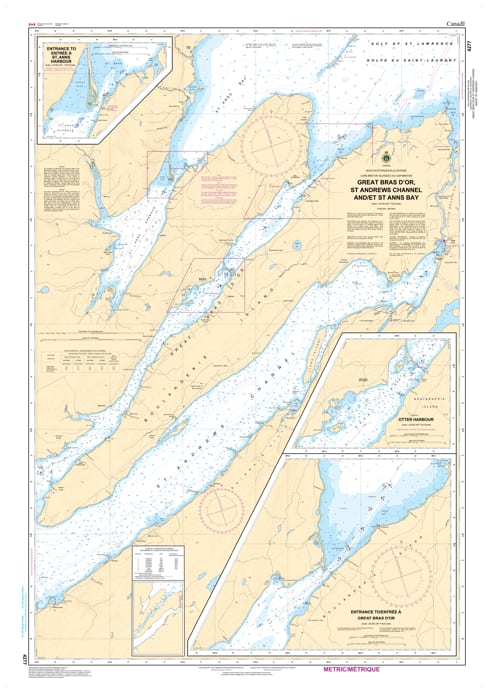
Navigate the primary northern arteries of Cape Breton’s inland sea with the CHS Nautical Chart 4277. This official chart from the Canadian Hydrographic Service (CHS) provides critical coverage for the Great Bras d'Or channel, St. Andrews Channel, and the majestic St. Anns Bay.
As the main deep-water entrance for vessels entering the Bras d'Or Lakes from the Atlantic, the Great Bras d'Or channel requires precise navigation. This chart offers high-resolution bathymetry and hydrographic data, ensuring mariners can safely manage the significant tidal currents and narrow passages characteristic of this region. Whether you are heading to the bustling docks of Baddeck or exploring the rugged coastline of St. Anns, Chart 4277 is your primary safety resource.
Key Navigational Features:
Bilingual Documentation: Features official nomenclature in both English and French (Great Bras d'Or / Grand Bras d'Or).
Comprehensive Waterway Coverage: Detailed soundings and shoreline data for the Great Bras d'Or, the deep St. Andrews Channel, and the entirety of St. Anns Bay.
Essential Marine Data: Clearly marked aids to navigation, including lights, buoys, beacons, and shore-based landmarks.
Safety First: Identifies underwater hazards, shoals, and seabed characteristics vital for anchoring and transit.
Professional Standards: Heavy-duty print quality that meets official carriage requirements for commercial and recreational vessels in Canadian waters.
From the Seal Island Bridge to the open Atlantic reaches, this chart is a "must-have" for any captain, fisherman, or cruising sailor traversing the Northeastern shores of Nova Scotia.