National Geographic’s Trails Illustrated map of Indian Peaks, Gold Hill combines unmatched detail with helpful information to offer an invaluable tool for enjoying the variety of recreation opportunities available in this section of the Rocky Mountains. Expertly researched and created in partnership with local land management agencies, this map features key points of interest including Indian Peaks Wilderness, Arapaho National Forest, Arapaho National Recreation Area, Gold Hill, Nederland, and the scenic Peak to Peak Highway.
National Geographic’s Trails Illustrated map of Flat Tops North in Colorado is designed to meet the needs of outdoor enthusiasts with unmatched durability and detail. Expertly researched and created in partnership with local land management agencies, this map features key points of interest including Trappers Lake, Meeker, the Flat Tops Trail Scenic Byway, Flat Tops Wilderness area and the Oak Ridge State Wildlife Area.
National Geographic's Trail Illustrated map of Flat Tops South offers unparalleled detail for outdoor enthusiasts looking to explore this area of Colorado, regardless of the season. Expertly researched and created in partnership with the U.S. Forest Service, Bureau of Land Management and others, this map features key points of interest, including White River National Forest, Flat Tops Wilderness, Hardscrabble and Gypsum Hills Recreation Areas, Rifle Falls and Rifle Gap State Parks, Glenwood Canyon plus the Colorado and Eagle Rivers.
In Sequioa and Kings Canyon National Parks you can walk among the world’s largest trees, hike the alpine landscape of the Sierra Crest, and marvel at the towering granite cliffs of one of the deepest canyons in the United States. National Geographic’s Trails Illustrated map of Sequoia and Kings Canyon National Parks provides unmatched detail of these parks, meeting the needs of amateur and experienced outdoor enthusiasts alike. Created in partnership with local land management agencies, this expertly researched map features key areas of interest including Sequoia Grove; Giant Sequoia National Monument; John Muir, Golden Trout, Jennie Lakes and Monarch Wilderness Areas; John Muir Trail; Pacific Crest Trail; and Mt. Whitney, the highest peak in the contiguous United States.
The Santa Monica Mountains National Recreation Area Trails Illustrated Map details the largest urban park in the United States from Point Mugu to Will Rogers State Beach. This map contains latitude/longitude and UTM grids, park activity guide, safety information, and completely researched and revised trails, recreational points-of-interest, boundaries, and roads.
National Geographic’s Trails Illustrated map of the Old Faithful area of Yellowstone National Park is designed to meet the needs of outdoor enthusiasts with unmatched detail of the south-west section of the national park. Expertly researched and created in partnership with local land management agencies, this map features key points of interest including the Old Faithful geyser area, the West Thumb of Yellowstone Lake, South Entrance Station, West Yellowstone, Heart Lake, and John D. Rockefeller Jr. Memorial Parkway. The Continental Divide Trail is also covered on this map.
National Geographic’s Trails Illustrated map of the Mammoth Hot Springs area of Yellowstone National Park is designed to meet the needs of outdoor enthusiasts with unmatched detail of the north-west section of the national park. Expertly researched and created in partnership with local land management agencies, this map features key points of interest including the Mammoth Hot Springs area, Canyon Village, South Entrance Station, West Yellowstone, Upper Yellowstone Falls, Gallatin National Forest, Absaroka-Beartooth Wilderness, and Lee Metcalf Wilderness.
The Yosemite Valley is a popular tourist destination, hosting millions of visitors each year. The glacial valley framed by such awe-inspiring granite formations as El Capitan and Half Dome is known for its dramatic waterfalls, giant sequoia groves, and biological diversity. National Geographic’s Trails Illustrated map of Yosemite SW: Yosemite Valley and Wawona delivers unmatched detail and valuable information to assist you in your exploration of this spectacular wilderness. Created in partnership with local land management agencies, this expertly researched map features key areas of interest including Yosemite Valley, Wawona, White Wolf, Merced and South Fork Merced rivers, and Sierra National Forest.
National Geographic’s Trails Illustrated map of Yosemite SE delivers unmatched detail and valuable information to assist you in your exploration of this breathtaking wilderness. Created in partnership with local land management agencies, this expertly researched map delivers unmatched detail and helpful information for experienced outdoor enthusiasts and casual visitors alike. Some of the key areas of interest included are Tuolomne Meadows; Garnet, Thousand Island, Tenaya and Merced lakes; Moraine Meadows; Quartz Mountain; and the Cathedral Range.
This title provides an increased scale of one of the most visited National Parks in the US, and one of our more popular map titles. This increased scale will provide greater detail to the backcountry users and Appalachian Trail through-hikers.
An abundance of recreational opportunities abound in the Chattahoochee National Forest, just north of Atlanta. National Geographic’s Trails Illustrated map of Springer and Cohutta Mountains delivers unmatched detail and valuable information to assist you in your exploration of these regions of the forest. Expertly researched and created in partnership with local land management agencies, this map features key points of interest including Blue Ridge, Nottely and Conasauga lakes; Fort Mountain and Amicalola state parks; Whissenhunt Mountain; Coosawattee Wildlife Management Area; Ed Jenkins National Recreation Area, and more.
Expertly researched and created in partnership with local land management agencies, National Geographic’s Trails Illustrated map of Linville Gorge and Mount Mitchell provides an unparalleled tool for exploring these remarkable features within Pisgah National Forest. This map includes such key areas of interest as Linville Gorge Wilderness, Mount Mitchell State Park, Craggy Gardens, Grandfather Mountain Biosphere Reserve, Lake James State Park, and Brown Mountain OHV Area.
National Geographic's Trails Illustrated map of Angeles National Forest is a two-sided, waterproof map designed to meet the needs of outdoor enthusiasts with unmatched durability and detail. This map was created in conjunction with local land management agencies and is loaded with valuable recreation information.
One of five new Trails Illustrated maps for the Washington Cascades region offering the most detailed and up-to-date map for the forest, carefully researched and developed in co-operation with local land managers and agencies. Each map contains easy to read trails, numbered forest service roads, campsites, access points, scenic points-of-interests, and important facilities.
One of five new Trails Illustrated maps for the Washington Cascades region offering the most detailed and up-to-date map for the forest, carefully researched and developed in co-operation with local land managers and agencies. Each map contains easy to read trails, numbered forest service roads, campsites, access points, scenic points-of-interests, and important facilities.
The largest park in the contiguous United States, Adirondack Park is a diverse mountain landscape of protected boreal forests and pristine waterways interspersed with over one hundred towns and villages. National Geographic’s Trails Illustrated map of Adirondack Park combines unmatched detail with helpful information to offer an invaluable tool for making the most of your visit to this extraordinary region. Created in partnership with local land management agencies, this expertly researched map features key areas of interest including High Peaks Wilderness, Lake Placid, Sentinel Range Wilderness, Saranac Lakes Wild Forest, Lake Champlain, Giant Mountain Wilderness, Hurricane Mountain Wilderness, Split Rock Mountain Wild Forest, and Long Lake.
Explore the exhilarating majesty and mystique of Southeast Alaska with National Geographic's Alaska's Inside Passage DestinationMap. The Inside Passage is a meandering waterway formed by a myriad of islands that lie between the North Pacific Ocean and the quieter waters along the coast. At its heart is the Tongass National Forest, the largest national forest in the United States which at a staggering 16.8 million acres contains 19 designated wilderness areas and the Admiralty Island and Misty Fiords National Monuments.
National Geographic's Alaska AdventureMap is designed to meet the unique needs of adventure travelers with its durability and detailed, accurate information. The map includes the accurate locations of all cities and towns with a user-friendly index, plus a clearly marked road network complete with distances and designations for major highways, main roads, plus tracks and trails for those seeking to explore more remote parts of the Islands.
National Geographic's Annapurna, Nepal AdventureMap is designed to meet the unique needs of adventure travelers, highlighting hundreds of points of interest and the diverse and unique destinations within the country.
With over 2,000 natural stone arches and hundreds of other extraordinary geological formations, Arches National Park is a red rock wonderland. National Geographic’s Trails Illustrated map of the park combines unmatched detail with helpful information to offer an invaluable tool for making the most of your visit to this iconic region. Created in partnership with local land management agencies, this expertly researched map features key areas of interest including Devils Garden, the Windows Section, Sand Flats Recreation Area, the Sovereign area, and Wolfe Ranch. The print version of the map includes fascinating information about the park’s geology, archeology, history, and culture, as well as contact information and regulations.
National Geographic's Baja California North, Mexico AdventureMap is designed to meet the unique needs of adventure travelers, highlighting hundreds of points of interest and the diverse and unique destinations within the country.
National Geographic's Baja California, South, Mexico AdventureMap is designed to meet the unique needs of adventure travelers, highlighting hundreds of points of interest and the diverse and unique destinations within the country.
National Geographic's Trails Illustrated map of Banff North is a two-sided, waterproof map designed to meet the needs of outdoor enthusiasts with unmatched durability and detail. This map was created in conjunction with local land management agencies and is loaded with valuable recreation information.
National Geographic's Trails Illustrated map of Banff South is a two-sided, waterproof map designed to meet the needs of outdoor enthusiasts with unmatched durability and detail. This map was created in conjunction with local land management agencies and is loaded with valuable recreation information.
National Geographic’s Trails Illustrated map of Boulder and Golden combines unmatched detail with helpful information to offer an invaluable tool for making the most of your exploration of the central Colorado Front Range. Expertly researched and created in partnership with local land management agencies, this map features key points of interest including Boulder Mountain Park, Clear Creek, Golden Gate Canyon State Park, Alderfer/Three Sisters Park, Lookout Mountain, and the iconic Red Rocks amphitheater. The communities of Lyons, Boulder, Golden, Morrison, Aspen Park, and Evergreen are also covered on this map.
National Geographic’s Trails Illustrated map of Bryce Canyon National Park is designed to meet the needs of outdoor enthusiasts by combining valuable information with unmatched detail of this unique landscape of hoodoos and forest. Created in partnership with local land management agencies, this expertly researched map will help you get the most from your visit with backpacking and day hike trail summaries, accurate road network, trailheads, campgrounds, lodging, and scenic viewpoints. The map features many key points of interest including Rainbow Point, Ruby’s Inn, and Natural Bridge. Portions of Grand Staircase – Escalante National Monument and Dixie National Forest are included as well. The print map includes an inset of Bryce Amphitheater, information on the park’s geology, natural history, weather, history and culture, regulations, and more.
National Geographic's Canada Central AdventureMap is designed to meet the needs of adventure travelers with its durability and detailed, accurate information. The map includes the locations of cities and towns with a user-friendly index, a clearly marked road network complete with distances and designations for roads/highways, plus secondary routes for those seeking to explore off the beaten path for destinations between Alberta and Ontario.
National Geographic's Canada East AdventureMap is designed to meet the needs of adventure travelers with its durability and detailed, accurate information. The map includes the locations of cities and towns with a user-friendly index, a clearly marked road network complete with distances and designations for roads/highways, plus secondary routes for those seeking to explore the stark wilderness of Newfoundland, the fertile farms of Prince Edward Island, or Nova Scotia's hidden coves and beaches.
National Geographic's Canadian Rockies DestinationMap strikes the perfect balance between map and guidebook and is an ideal resource for touring this culturally and geographically unique region. Canada's share of the Rocky Moutains averages approximately 100 miles across (160 kilometers) and runs from Waterton Lakes National Park on the Alberta-Montana border northwest towards the Yukon territory.
National Geographic’s Trails Illustrated map of Canyonlands National Park is designed to meet the needs of outdoor enthusiasts by combining valuable information with unmatched detail of this mesmerizing landscape of river canyons and fantastically formed buttes. Expertly researched and created in partnership with local land management agencies, this map is loaded with helpful information on the park’s archaeology, Glen Canyon, Horseshoe Canyon, backcountry safety, park regulations and more. Key areas of interest featured on this map include Canyon Rims Recreation Area; Glen Canyon National Recreation Area; the Island in the Sky district; the Needles district; and the Maze district.
Capitol Reef National Park is a hidden gem located in the Waterpocket Fold, a wrinkle in the earth that extends nearly 100 miles through south-central Utah’s red rock country. National Geographic’s Trails Illustrated map of Capitol Reef provides unmatched detail of the park to meet the needs of amateur and experienced outdoor enthusiasts alike. Created in partnership with local land management agencies, this expertly researched map features the entire park as well as adjacent areas of interest including Anasazi State Park and portions of Fishlake National Forest, Grand Staircase-Escalante National Monument, and Dixie National Forest.
National Geographic's Caribbean DestinationMap strikes the perfect balance between map and guidebook and is ideal for a wide range of travelers. The map includes a detailed road network and important travel information including National Parks and protected areas, airports, cruise ports, beaches, historic sites and ruins, and sites for recreation activities including diving, surfing, sailing, and golfing.
National Geographic's China, East AdventureMap is designed to meet the unique needs of adventure travelers with its durability and accurate information. This folded map provides global travelers with the perfect combination of detail and perspective, highlighting hundreds of points of interest and the diverse and unique destinations within the country.
National Geographic's China, West AdventureMap is designed to meet the unique needs of adventure travelers with its durability and accurate information. This folded map provides global travelers with the perfect combination of detail and perspective, highlighting hundreds of points of interest and the diverse and unique destinations within the country.
Colorado has the highest mean elevation of any state in the United States. It’s home to 58 mountain peaks higher than 14,000 feet—more than any other state in the U.S—making it a mountain sports mecca. “Bagging” these fourteeners is a goal for many Coloradans and visitors to the state—and for some, it’s an obsession.
Colorado has the highest mean elevation of any state in the United States. It’s home to 58 mountain peaks higher than 14,000 feet—more than any other state in the U.S—making it a mountain sports mecca. “Bagging” these fourteeners is a goal for many Coloradans and visitors to the state—and for some, it’s an obsession.
The magnificent Multnomah Falls is just one of many natural, cultural, and recreational attractions in the Columbia River Gorge Scenic Area. The 80-mile-long gorge contains diverse ecosystems ranging from the lush Oneonta Gorge Rain Forest to the arid Celilo Grasslands. Expertly researched and created in partnership with local land management agencies, National Geographic’s Trails Illustrated map of Columbia River Gorge provides an unparalleled tool for exploring this breathtaking region. Some of the key areas of interest featured on the map include the White Salmon, Klickitat, Sandy, and Lower Deschutes rivers; Yacolt Burn State Forest; Maryhill, Columbia Hills, and Rooster Rock state parks; Mark O. Hatfield Wilderness; and portions of Mount Hood and Gifford-Pinchot national forests.
National Geographic's Corsica AdventureMap is designed to meet the unique needs of adventure travelers with its durability and accurate information. This folded map provides global travelers with the perfect combination of detail and perspective, highlighting hundreds of points of interest and the diverse and unique destinations within the country.
National Geographic's Costa Rica AdventureMap is designed to meet the unique needs of adventure travelers, highlighting hundreds of points of interest and the diverse and unique destinations within the country.
This Trails Illustrated topographic map for Crater Lake National Park and surrounding area is the perfect map for hiking, biking, exploring, climbing, camping, and sightseeing in this beautiful area.
National Geographic's Crete AdventureMap is designed to meet the unique needs of adventure travelers with its durability and accurate information. This folded map provides global travelers with the perfect combination of detail and perspective, highlighting hundreds of points of interest and the diverse and unique destinations within the country.
National Geographic's Czech Republic AdventureMap is designed to meet the unique needs of adventure travelers with its durability and accurate information. This folded map provides global travelers with the perfect combination of detail and perspective, highlighting hundreds of points of interest and the diverse and unique destinations within the country.
Despite its foreboding name and the fact that it is the hottest, lowest, and driest area in North America, Death Valley National Park maintains a great diversity of life in its dramatic terrain of salt-flats, canyons, mountains, valleys, sand dunes, and badlands. National Geographic’s Trails Illustrated map of Death Valley National Park delivers unmatched detail and valuable information to assist you in your visit to this land of extremes. Expertly researched and created in partnership with local land management agencies, this map features key areas of interest including Badwater Basin, Furnace Creek, Scotty’s Castle, Panamint Springs, and Stovepipe Wells.
Denali National Park and Preserve covers a staggering six million acres of truly wild and pristine wilderness, bisected by a single road. The crown jewel of the park is the towering 20,320 foot Mount McKinley, North America’s tallest peak. Expertly researched and created in partnership with local land management agencies, National Geographic’s Trails Illustrated map of Denali National Park provides an unparalleled tool for exploring this remarkable region. Key areas of interest featured on this map include Denali State Park; Kroto, Moose Creek, and Lake Creek recreation rivers; Lake Minchumina; and the Kantishna Mining District. The print version of the map includes a detailed inset of the park entrance and headquarters.
National Geographic's Ecuador and Galapagos Islands AdventureMap is designed to meet the unique needs of adventure travelers with its durability and accurate information. This folded map provides global travelers with the perfect combination of detail and perspective, highlighting hundreds of points of interest and the diverse and unique destinations within the country.
National Geographic's Everest Base Camp AdventureMap is designed to meet the unique needs of adventure travelers, highlighting hundreds of points of interest and the diverse and unique destinations within the country.
National Geographic's Flagstaff and Sedona Trails Illustrated topographic map is the most comprehensive available for outdoor enthusiasts of all types. Designed to be easy-to-read, yet highly detailed – this map includes a comprehensive road and trail network distinguishing between major, secondary, high-clearance, OHV routes, hiking, horse, biking, multi-use, motorized and non-motorized trails. All forest roads are labeled with their official road number and trails are clearly identified with their given name. Boundaries are color-coded and clearly shown for National Forest, National Monument, Ranger Districts, Wilderness Areas, State Park, State Wildlife Areas, Department of Defense, and Indian Reservation lands. Additionally, Arizona Game Management Unit (GMU) boundaries and public and private lands are clearly identified.
National Geographic's France AdventureMap is designed to meet the unique needs of adventure travelers with its durability and accurate information. This folded map provides global travelers with the perfect combination of detail and perspective, highlighting hundreds of points of interest and the diverse and unique destinations within the country.
The front side is an easy-to-read road map with insets of: - Athens - Augusta - Albany - Savannah - Brunswick / Jekyll Island - Columbus - Macon The back includes: - Points of interest - Information and map of Atlanta - Information for Okefenokee National Wildlife Refuge and Swamp Park - Scenic drive - Park Service sites in Georgia.
National Geographic's Germany AdventureMap is designed to meet the unique needs of adventure travelers with its durability and accurate information. This folded map provides global travelers with the perfect combination of detail and perspective, highlighting hundreds of points of interest and the diverse and unique destinations within the country.
National Geographic’s Trails Illustrated map of Glacier and Waterton Lakes National Parks offers unparalleled detail for outdoor enthusiasts exploring the pristine landscape of forests, mountains, lakes, and meadows within these two spectacular parks. Created in partnership with local land management agencies, this expertly researched map features key areas of interest including Many Glacier, Great Bear Wilderness, Flathead National Forest, Hungry Horse Reservoir, Lake McDonald, Flathead River, St. Mary Lake, Akamina-Kishinena Provincial Park, and the Waterton Lakes.
This Trails Illustrated map for Glacier Bay National Park, Glacier Bay National Preserve, and surrounding area and surrounding area in Alaska's panhandle is perfect for hiking, camping, boating, paddling, and wildlife viewing in this scenic, rugged frontier.
National Geographic’s Trails Illustrated map of North Fork in Glacier National Park will benefit even the most experienced outdoors enthusiast, as you explore this pristine landscape that has very few amenities. Two additional maps for Many Glacier and the Two Medicine regions of the park along with a comprehensive Glacier National Park Trails Illustrated map are also available.Created in partnership with the National Park Service, U.S. Forest Service and others, this expertly researched map features key areas of interest such as Bowman Lake, Lake McDonald Valley, Goat Haunt and Avalanche Creek.
National Geographic’s Trails Illustrated map of Two Medicine delivers unmatched detail and valuable information to assist you year-round in your exploration of southeastern Glacier National Park. Expertly researched and created in partnership with local land management agencies, this map includes helpful contact information, backcountry hiking and camping tips and regulations, snow hazard areas, safety tips, and more. The map features many key areas of interest including John Stevens Canyon, St. Mary's Lake, Lake McDonald and the historic Going-to-the-Sun road.
Our Glen Canyon NRA and Rainbow Bridge NM Trails Illustrated map provides detailed topographic coverage, trails, and locations of important recreational points of interest for outdoor enthusiasts. Inset maps for Hite, Halls Crossing, Dangling Rope, Bullfrog Bay, and Wahweap marinas and campgrounds show the location of key facilities such as boat ramps, RV campgrounds, laundry facilities, and parking.
Explore the splendor of the Grand Canyon from Glen Canyon to Grand Canyon Village on the south rim with National Geographic’s Trails Illustrated map of Grand Canyon East. Expertly researched and created in partnership with local land management agencies, this map features key points of interest including Paria Canyon-Vermilion Cliffs Wilderness, Kaibab National Forest, Saddle Mountain Wilderness, Marble Canyon, and the Colorado River.
With over 5 million visitors each year, Grand Canyon National Park, is one of America's most popular destinations. Over 1.2 million acres in size, the park spans from Lake Mead and Parashant National Monument at its western edge to Glen and Paria Canyons at the East. Grand Canyon National Park and its neighboring National Forests and wilderness areas offer a wide range of recreational opportunities, from sightseeing to overnight family camping to rigorous backcountry itineraries and river float trips.
National Geographic’s Trails Illustrated map of Grand Canyon West covers some of the less frequented but just as wondrous landscape of Grand Canyon National Park, from Powell Plateau to the park's western boundary. Expertly researched and created in partnership with the National Park Service, U.S. Forest Service, Bureau of Land Management and others, the map also covers the surrounding areas of Kaibab National Forest, Hualapai Havasupai Indian Reservations and Parashant National Monument. With so much of the area being backcountry, the map also includes useful backcountry information, regulations and safety tips, in addition to a backcountry use area guide, coded by degree of experience required.
Expertly researched and created in partnership with local land management agencies, National Geographic’s Trails Illustrated map of Grand Teton National Park provides an unparalleled tool for exploring this magnificent region. This map offers unmatched detail of the entire park and features key areas of interest including Jackson Hole, Jackson Lake, Colter Bay Village, Jenny Lake, Phelps Lake, Teton Crest Trail, Bridger-Teton National Forest, Caribou-Targhee National Forest, Gros Ventre Wilderness, Jedediah Smith Wilderness, and John D. Rockefeller Jr. Memorial Parkway.
National Geographic's Greece AdventureMap is designed to meet the unique needs of adventure travelers with its durability and accurate information. This folded map provides global travelers with the perfect combination of detail and perspective, highlighting hundreds of points of interest and the diverse and unique destinations within the country.
This Trails Illustrated topographic map for Hawaii Volcanoes National Park on the island of Hawaii, highlighting two of the world's most active volcanoes, and dramatic views of the volcanic landscape that has emerged.
A highly-detailed recreation map for Idaho printed on waterproof synthetic paper. Public lands, hunting zones, extensive backcountry road detail and recreation listings are featured.
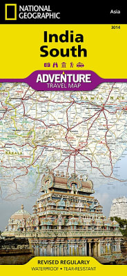
National Geographic's India, South AdventureMap is designed to meet the unique needs of adventure travelers with its durability and accurate information. This folded map provides global travelers with the perfect combination of detail and perspective, highlighting hundreds of points of interest and the diverse and unique destinations within the country.
National Geographic's Ireland AdventureMap is designed to meet the unique needs of adventure travelers with its durability and accurate information. This folded map provides global travelers with the perfect combination of detail and perspective, highlighting hundreds of points of interest and the diverse and unique destinations within the country.
National Geographic's Italy AdventureMap is designed to meet the unique needs of adventure travelers with its durability and accurate information. This folded map provides global travelers with the perfect combination of detail and perspective, highlighting hundreds of points of interest and the diverse and unique destinations within the country.
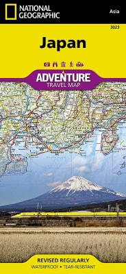
National Geographic's Japan AdventureMap is designed to meet the unique needs of adventure travelers with its durability and accurate information. This folded map provides global travelers with the perfect combination of detail and perspective, highlighting hundreds of points of interest and the diverse and unique destinations within the country.
National Geographic's Trails Illustrated map of Jasper North is a two-sided, waterproof map designed to meet the needs of outdoor enthusiasts with unmatched durability and detail. This map was created in conjunction with local land management agencies and is loaded with valuable recreation information.
National Geographic's Trails Illustrated map of Jasper South is a two-sided, waterproof map designed to meet the needs of outdoor enthusiasts with unmatched durability and detail. This map was created in conjunction with local land management agencies and is loaded with valuable recreation information.
The two distinct ecosystems of the Colorado Desert and the Mojave Desert meet in southeastern California in the Joshua Tree National Park. National Geographic’s Trails Illustrated map of the park delivers unmatched detail and valuable information to assist you in your exploration of this fascinating land of surreal geologic features shaped by strong winds, unpredictable torrents of rain, and climatic extremes. Created in partnership with local land management agencies, this expertly researched map features key areas of interest including Black Rock Canyon, Lost Horse Valley, Indian Cove, Cottonwood, Chuckwalla Valley, and the Pinto Mountains.
National Geographic's Langtang, Nepal AdventureMap is designed to meet the unique needs of adventure travelers with its durability and accurate information. This folded map provides global travelers with the perfect combination of detail and perspective, highlighting hundreds of points of interest and the diverse and unique destinations within the country.
In addition to the easy-to-read map on the front, the back includes: - Regional map - Points of interest - Inset map of Downtown Las Vegas - Airport diagram - Information for Grand Canyon and Bryce Canyon National Parks - Multi-language legend.