QUESTIONS? CALL OR TEXT! 1 (877) 921-6277 or (403) 266-2241
WE SHIP EVERYWHERE!

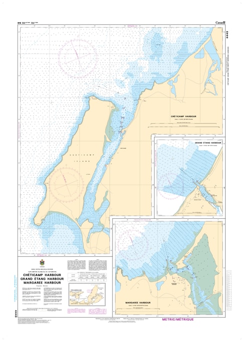
Navigate the rugged western coastline of Cape Breton Island with the precision of CHS Nautical Chart 4449. Providing specialized, large-scale coverage of Chéticamp, Grand Étang, and Margaree Harbours, this chart is an essential resource for mariners traversing the vibrant fishing grounds of the Gulf of St. Lawrence. This region is known for its high-energy coastline, significant tidal surges, and the dramatic backdrop of the Cape Breton Highlands, requiring the detailed hydrographic data found only in official Canadian Hydrographic Service documents.
Chart 4449 features high-resolution insets for each of these historic Acadian and coastal communities. It provides critical mapping for the deep-water harbor at Chéticamp, sheltered by Chéticamp Island, as well as the narrow, tide-swept entrances to the Grand Étang lagoon and the mouth of the world-famous Margaree River. Whether you are a commercial snow crab fisher, a seasonal sailor visiting the Highlands, or a GIS professional, this chart offers the soundings, navigational aids, and shoreline detail necessary for safe transit through these vital Inverness County ports.
Key Features include:
Triple Harbour Insets: Detailed large-scale mapping for the Chéticamp waterfront, the Grand Étang breakwaters, and the Margaree Harbour bar.
Hydrographic Accuracy: Features precise depth soundings and seabed composition essential for navigating the shifting sands of the Margaree estuary.
Navigational Infrastructure: Clearly identifies the Chéticamp wharves, regional lighthouses, and the range lights required for safe harbour entry.
Safety & Hazard Identification: Clearly marks the "Enragée Point" shoals and the rocky ledges common to the western Cape Breton shoreline.
Professional Grade: Produced to the rigorous standards of the Canadian Hydrographic Service (CHS) for professional navigation, maritime safety, and regional logistics.