QUESTIONS? CALL OR TEXT! 1 (877) 921-6277 or (403) 266-2241
WE SHIP EVERYWHERE!

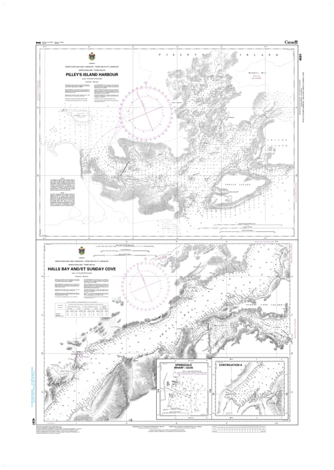
Navigating the complex, island-dense waterways of Notre Dame Bay requires highly specialized cartography, and the official Canadian Hydrographic Service (CHS) Nautical Chart 4591 delivers absolute precision. This professional-grade paper marine chart provides authoritative, high-resolution hydrographic data for Pilley's Island Harbour, Halls Bay, and Sunday Cove along the rugged northeast coast of Newfoundland. Engineered specifically to support commercial mariners, local fishing fleets, and recreational boaters, this chart is the indispensable safety standard required for transiting these tight coastal tickles and deep-water arms.
Spanning a standard large-format 47 x 34 inches, Chart 4591 features detailed, high-density depth soundings, clear underwater hazard markings (including shallow shoals, ledges, and submerged rocks), and critical aids to navigation such as harbor lights, buoys, and shoreline terrain contours. The specialized layout provides exceptional clarity for navigating the narrow channels surrounding Pilley's Island and the expansive reaches of Halls Bay, ensuring safe passage and precise pilotage even when facing unpredictable North Atlantic weather. Bilingual in English and French, this official CHS chart is printed on demand using premium, high-contrast paper, guaranteeing maximum legibility on your vessel's navigation table under all lighting conditions.