Custom GIS Mapping & Personalized Map Design
Doyou need a unique, data-driven map for your business or project? AtMap Town, we specialize in custom GIS mapping, Web based Applications, data and tailoredcartography services. From detailed Business Territory maps tocomplex Oil and Gas project mapping, we create high-quality,professional maps that meet your exact specifications. With over 35 years of experience and thousands of custom projects completed, weprovide cost-effective solutions for all your mapping needs.
WhyInvest in a Custom GIS Map?
Acustom-designed map is more than just a picture—it’s a powerfultool for visualizing data, making informed decisions, andcommunicating information effectively.
- Tailored to Your Needs: You have complete control. We work withyou to choose the Geographic Information System (GIS) data layers,level of detail, map style, and specific features that are mostimportant to you- Professional Quality & Accuracy: Our team of expert cartographers andGIS specialists use advanced tools and high-resolution satelliteimagery to ensure your map is not only visually stunning but alsohighly accurate and professional.
- PowerfulBusiness & Marketing Tool: A custom map can be akey asset for branding and marketing. Showcase your service areas,highlight key locations, and reinforce your brand identity with aunique visual.
- Enhance Decision-Making: Integrate your own proprietary data tocreate maps that help you analyze patterns, streamline operations,and improve strategic decision-making.
OurCustom GIS Mapping Services
MapTown provides GIS mappingservices for a wide range of industries and applications, creatingdetailed maps for clients around the globe.
- Agriculture: Soilanalysis, crop rotation, and land use mapping
- Business:Sales territories, service areas, and competitor analysis maps
-Construction: Siteplans, project locations, and infrastructure mapping
-Environmental: Wildlifehabitat, natural resource, and environmental impact mapping
-Government: Zoning,utility, and municipal base maps
-Oil & Gas: Reserve data, pipeline networks, anddrilling site maps
-Transportation: Routeoptimization, logistics, and transit schedule maps
-Outdoor Recreation: Topographic maps for hiking, backcountry,and hunting
-Specialty Maps: We create maps for specific needs, including fireand flood hazard maps, seismic data, and more
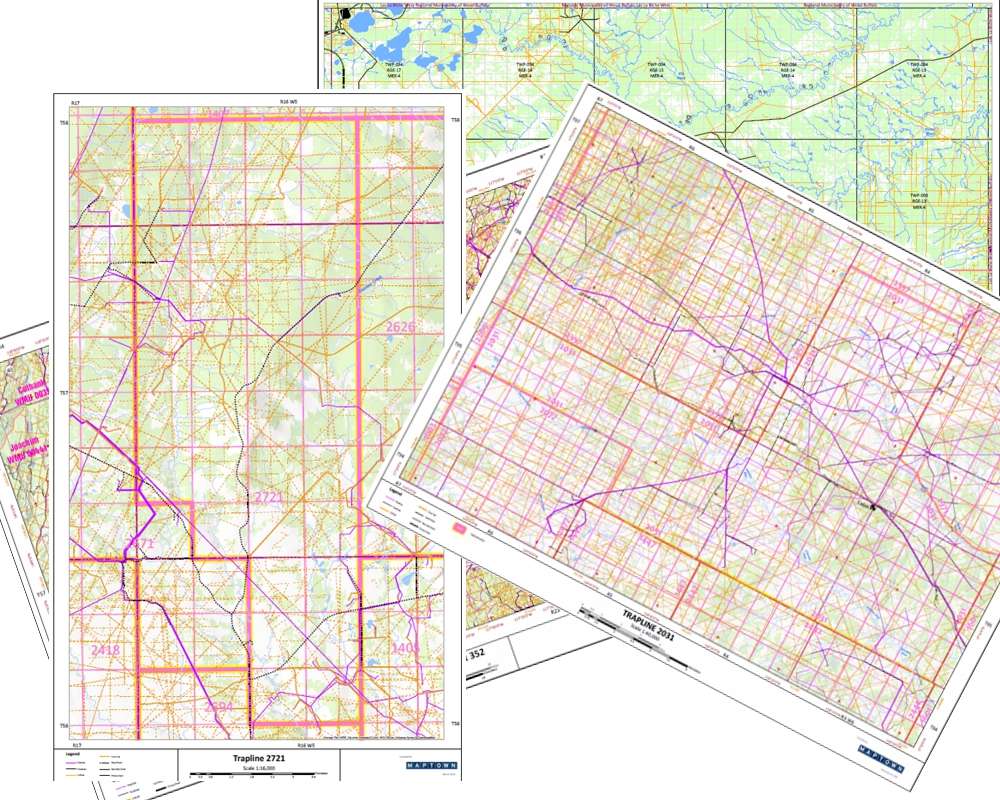
CustomAlberta & BC WMU Trapline Maps
MapTown is your premier source for custom trapline maps in Alberta andBC. Our Registered Fur Management Area & WMU (Wildlife Management Units) maps are centered on yourspecific trapline, providing detailed access information, includingroads, trails, cutlines, pipelines, Satellite Imagery and more. We integrate keydetails like your cabin location, vegetation layers, and contourlines, with your choice of Latitude/Longitude, UTM and Township and Section grids.
Startingat $225: Get a custom trapline map, including a high-resolution PDFand a laminated paper copy.
Contactus todayfor a detailed quote and sample for your custom project