QUESTIONS? CALL OR TEXT! 1 (877) 921-6277 or (403) 266-2241
WE SHIP EVERYWHERE!


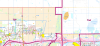
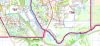
The Calgary Detailed Postal Codes Wall Map is a comprehensive logistics and planning tool designed for businesses, residents, and urban planners. This new 2026 version expansive 38" x 50" base map provides an unparalleled look at the city of Calgary and the surrounding region, with a primary focus on FSAs (Forward Sortation Areas)—the first three digits of the Canadian postal code—allowing for efficient territory management and delivery routing.
The map is engineered for high readability, featuring a detailed network of primary and secondary roads, including future-planned streets and the completed Stoney Trail (Ring Road) in the Southwest. For commuters and transit planners, the map explicitly details current and proposed LRT Transit Lines and stations.
Advanced Data Layers Include:
Public Services: Symbolized icons for schools (categorized by type), EMS, fire stations, hospitals, and police headquarters.
Urban Infrastructure: Landmarks including community centers, libraries, shopping malls, sport facilities, and the Tsuu T’ina First Nation.
Zoning & Land Use: Distinct color-coding for retail, industrial, commercial core, and the Transportation Utility Corridor (TUC).
Natural Features: Detailed rendering of parks, golf courses, green spaces, provincial parks, lakes, and the Bow and Elbow Rivers.
Whether you are managing a commercial fleet or analyzing residential neighborhoods, this map offers the most detailed geospatial view of Calgary's evolving urban landscape.