Home > Maps > Canadian Topographic Maps > Canadian Topographic Block 022 > Canadian Topographic Block 022A

Canadian Topographic Maps - Block 022A


Use the following image to move to adjacent topo map indexes.

Sort By:
Page of 1
022A - GASPE - Topographic Map 022A02 - PORT-DANIEL - Topographic Map 022A03 - NEW CARLISLE - Topographic Map
022A04 - NEW RICHMOND - Topographic Map 022A05 - LAC MCKAY - Topographic Map 022A06 - RIVIERE REBOUL - Topographic Map
022A07 - CHANDLER - Topographic Map 022A08 - CAP D'ESPOIR - Topographic Map 022A09 - PERCE - Topographic Map
022A10 - SAINT-GABRIEL-DE-GASPE - Topographic Map 022A11 - MONT ALEXANDRE - Topographic Map 022A12 - RUISSEAU LESSEPS - Topographic Map
022A13 - LAC MADELEINE - Topographic Map 022A14 - LAC YORK - Topographic Map 022A15 - SUNNY-BANK - Topographic Map
022A16 - GASPE - Topographic Map


Back to the Block 022 Topographic Map Index.

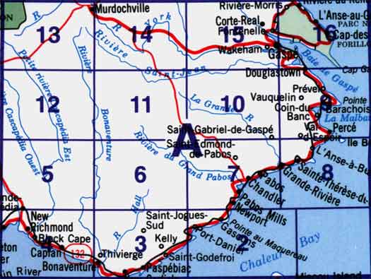
22A - Gaspé, 22A01 - Part Of 22A02 Port-Daniel, 22A02 - Port-Daniel, 22A03 - New Carlisle, 22A04 - New Richmond, 22A05 - Lac Mckay, 22A06 - Rivière Reboul, 22A07 - Chandler, 22A08 - Cap D'Espoir, 22A09 - Percé, 22A10 - Grande Rivière Nord, 22A11 - Mont Alexandre, 22A12 - Ruisseau Lesseps, 22A13 - Lac Madeleine, 22A14 - Lac York, 22A15 - Sunny-Bank, 22A16 - Gaspé. One or more of these maps cover Forillon National Park and a portion of Gaspésie Provincial Park