Home > Maps > Canadian Topographic Maps > Canadian Topographic Block 098

Canadian Topographic Maps - Northwest Territories


1:250 000 and 1:50 000 scale NTS Maps

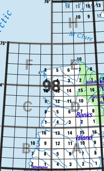
Click on an area of the map below to retrieve topo maps from our database.

Back to the Northwest Territories Topographical Maps Index.
Back to the Yukon Topographical Maps Index.

Each lettered square on the topo map index above represents the following 1:250 000 scale topographical maps: 98A - Jesse Harbour, 98B - Lennie River, 98C - Part Of 98D Bernard River, 98D - Bernard River, 98E - Cape M'Clure, 98F - Part Of 98E Cape M'Clure, 98H - Dyer Bay.

Sort By:
Page of 3
098A - JESSE HARBOUR - Topographic Map 098A01 - NO TITLE - Topographic Map 098A02 - NO TITLE - Topographic Map
The Canadian 1:250,000 scale paper topographic map series also known as topo or topographical maps is very useful for providing an overview of an area.  These paper or laminated maps include contour lines, water bodies, roads, population centres, treed areas, etc. Printed topo maps are great for recreational activities such as hiking, camping, biking or fishing.  Topographic maps have latitude and longitute and UTM coordinates. Topo maps can be used with a compass or a GPS unit.  Canadian topographical paper maps can be laminated - makes map waterproof - for an additional charge. As the most detailed country-wide map series, the 1:50,000 paper topographic series also known as topo or topographical is ideal for any purpose that requires good detail of an area.  These topographical paper maps include contour lines, water bodies, roads, trails, population centres, treed areas, etc. Printed Topo maps are great for recreational activities such as hiking, camping, biking or fishing.  Topographic maps have latitude and longitute and UTM coordinates. Topo paper maps can be used with a compass or a GPS unit. Printed Canadian topographical maps can be laminated - makes map waterproof - for an additional charge. As the most detailed country-wide map series, the 1:50,000 paper topographic series also known as topo or topographical is ideal for any purpose that requires good detail of an area.  These topographical paper maps include contour lines, water bodies, roads, trails, population centres, treed areas, etc. Printed Topo maps are great for recreational activities such as hiking, camping, biking or fishing.  Topographic maps have latitude and longitute and UTM coordinates. Topo paper maps can be used with a compass or a GPS unit. Printed Canadian topographical maps can be laminated - makes map waterproof - for an additional charge.
098A03 - NO TITLE - Topographic Map 098A04 - NO TITLE - Topographic Map 098A05 - BURNT TENT LAKE - Topographic Map
As the most detailed country-wide map series, the 1:50,000 paper topographic series also known as topo or topographical is ideal for any purpose that requires good detail of an area.  These topographical paper maps include contour lines, water bodies, roads, trails, population centres, treed areas, etc. Printed Topo maps are great for recreational activities such as hiking, camping, biking or fishing.  Topographic maps have latitude and longitute and UTM coordinates. Topo paper maps can be used with a compass or a GPS unit. Printed Canadian topographical maps can be laminated - makes map waterproof - for an additional charge. As the most detailed country-wide map series, the 1:50,000 paper topographic series also known as topo or topographical is ideal for any purpose that requires good detail of an area.  These topographical paper maps include contour lines, water bodies, roads, trails, population centres, treed areas, etc. Printed Topo maps are great for recreational activities such as hiking, camping, biking or fishing.  Topographic maps have latitude and longitute and UTM coordinates. Topo paper maps can be used with a compass or a GPS unit. Printed Canadian topographical maps can be laminated - makes map waterproof - for an additional charge. As the most detailed country-wide map series, the 1:50,000 paper topographic series also known as topo or topographical is ideal for any purpose that requires good detail of an area.  These topographical paper maps include contour lines, water bodies, roads, trails, population centres, treed areas, etc. Printed Topo maps are great for recreational activities such as hiking, camping, biking or fishing.  Topographic maps have latitude and longitute and UTM coordinates. Topo paper maps can be used with a compass or a GPS unit. Printed Canadian topographical maps can be laminated - makes map waterproof - for an additional charge.
098A06 - NO TITLE - Topographic Map 098A07 - NO TITLE - Topographic Map 098A08 - NO TITLE - Topographic Map
As the most detailed country-wide map series, the 1:50,000 paper topographic series also known as topo or topographical is ideal for any purpose that requires good detail of an area.  These topographical paper maps include contour lines, water bodies, roads, trails, population centres, treed areas, etc. Printed Topo maps are great for recreational activities such as hiking, camping, biking or fishing.  Topographic maps have latitude and longitute and UTM coordinates. Topo paper maps can be used with a compass or a GPS unit. Printed Canadian topographical maps can be laminated - makes map waterproof - for an additional charge. As the most detailed country-wide map series, the 1:50,000 paper topographic series also known as topo or topographical is ideal for any purpose that requires good detail of an area.  These topographical paper maps include contour lines, water bodies, roads, trails, population centres, treed areas, etc. Printed Topo maps are great for recreational activities such as hiking, camping, biking or fishing.  Topographic maps have latitude and longitute and UTM coordinates. Topo paper maps can be used with a compass or a GPS unit. Printed Canadian topographical maps can be laminated - makes map waterproof - for an additional charge. As the most detailed country-wide map series, the 1:50,000 paper topographic series also known as topo or topographical is ideal for any purpose that requires good detail of an area.  These topographical paper maps include contour lines, water bodies, roads, trails, population centres, treed areas, etc. Printed Topo maps are great for recreational activities such as hiking, camping, biking or fishing.  Topographic maps have latitude and longitute and UTM coordinates. Topo paper maps can be used with a compass or a GPS unit. Printed Canadian topographical maps can be laminated - makes map waterproof - for an additional charge.
098A09 - NO TITLE - Topographic Map 098A10 - NO TITLE - Topographic Map 098A11 - SUNGUKPALUK HILL - Topographic Map
As the most detailed country-wide map series, the 1:50,000 paper topographic series also known as topo or topographical is ideal for any purpose that requires good detail of an area.  These topographical paper maps include contour lines, water bodies, roads, trails, population centres, treed areas, etc. Printed Topo maps are great for recreational activities such as hiking, camping, biking or fishing.  Topographic maps have latitude and longitute and UTM coordinates. Topo paper maps can be used with a compass or a GPS unit. Printed Canadian topographical maps can be laminated - makes map waterproof - for an additional charge. As the most detailed country-wide map series, the 1:50,000 paper topographic series also known as topo or topographical is ideal for any purpose that requires good detail of an area.  These topographical paper maps include contour lines, water bodies, roads, trails, population centres, treed areas, etc. Printed Topo maps are great for recreational activities such as hiking, camping, biking or fishing.  Topographic maps have latitude and longitute and UTM coordinates. Topo paper maps can be used with a compass or a GPS unit. Printed Canadian topographical maps can be laminated - makes map waterproof - for an additional charge. As the most detailed country-wide map series, the 1:50,000 paper topographic series also known as topo or topographical is ideal for any purpose that requires good detail of an area.  These topographical paper maps include contour lines, water bodies, roads, trails, population centres, treed areas, etc. Printed Topo maps are great for recreational activities such as hiking, camping, biking or fishing.  Topographic maps have latitude and longitute and UTM coordinates. Topo paper maps can be used with a compass or a GPS unit. Printed Canadian topographical maps can be laminated - makes map waterproof - for an additional charge.
098A12 - NO TITLE - Topographic Map 098A13 - NO TITLE - Topographic Map 098A14 - STORKERSON LAKE - Topographic Map
As the most detailed country-wide map series, the 1:50,000 paper topographic series also known as topo or topographical is ideal for any purpose that requires good detail of an area.  These topographical paper maps include contour lines, water bodies, roads, trails, population centres, treed areas, etc. Printed Topo maps are great for recreational activities such as hiking, camping, biking or fishing.  Topographic maps have latitude and longitute and UTM coordinates. Topo paper maps can be used with a compass or a GPS unit. Printed Canadian topographical maps can be laminated - makes map waterproof - for an additional charge. As the most detailed country-wide map series, the 1:50,000 paper topographic series also known as topo or topographical is ideal for any purpose that requires good detail of an area.  These topographical paper maps include contour lines, water bodies, roads, trails, population centres, treed areas, etc. Printed Topo maps are great for recreational activities such as hiking, camping, biking or fishing.  Topographic maps have latitude and longitute and UTM coordinates. Topo paper maps can be used with a compass or a GPS unit. Printed Canadian topographical maps can be laminated - makes map waterproof - for an additional charge. As the most detailed country-wide map series, the 1:50,000 paper topographic series also known as topo or topographical is ideal for any purpose that requires good detail of an area.  These topographical paper maps include contour lines, water bodies, roads, trails, population centres, treed areas, etc. Printed Topo maps are great for recreational activities such as hiking, camping, biking or fishing.  Topographic maps have latitude and longitute and UTM coordinates. Topo paper maps can be used with a compass or a GPS unit. Printed Canadian topographical maps can be laminated - makes map waterproof - for an additional charge.
098A15 - NO TITLE - Topographic Map 098A16 - NO TITLE - Topographic Map 098B - LENNIE RIVER - Topographic Map
As the most detailed country-wide map series, the 1:50,000 paper topographic series also known as topo or topographical is ideal for any purpose that requires good detail of an area.  These topographical paper maps include contour lines, water bodies, roads, trails, population centres, treed areas, etc. Printed Topo maps are great for recreational activities such as hiking, camping, biking or fishing.  Topographic maps have latitude and longitute and UTM coordinates. Topo paper maps can be used with a compass or a GPS unit. Printed Canadian topographical maps can be laminated - makes map waterproof - for an additional charge. As the most detailed country-wide map series, the 1:50,000 paper topographic series also known as topo or topographical is ideal for any purpose that requires good detail of an area.  These topographical paper maps include contour lines, water bodies, roads, trails, population centres, treed areas, etc. Printed Topo maps are great for recreational activities such as hiking, camping, biking or fishing.  Topographic maps have latitude and longitute and UTM coordinates. Topo paper maps can be used with a compass or a GPS unit. Printed Canadian topographical maps can be laminated - makes map waterproof - for an additional charge. The Canadian 1:250,000 scale paper topographic map series also known as topo or topographical maps is very useful for providing an overview of an area.  These paper or laminated maps include contour lines, water bodies, roads, population centres, treed areas, etc. Printed topo maps are great for recreational activities such as hiking, camping, biking or fishing.  Topographic maps have latitude and longitute and UTM coordinates. Topo maps can be used with a compass or a GPS unit.  Canadian topographical paper maps can be laminated - makes map waterproof - for an additional charge.
098B01 - IMNAUGALUIT HILLS - Topographic Map 098B02 - BLUE FOX HARBOUR - Topographic Map 098B07 - SIKSIK POINT - Topographic Map
As the most detailed country-wide map series, the 1:50,000 paper topographic series also known as topo or topographical is ideal for any purpose that requires good detail of an area.  These topographical paper maps include contour lines, water bodies, roads, trails, population centres, treed areas, etc. Printed Topo maps are great for recreational activities such as hiking, camping, biking or fishing.  Topographic maps have latitude and longitute and UTM coordinates. Topo paper maps can be used with a compass or a GPS unit. Printed Canadian topographical maps can be laminated - makes map waterproof - for an additional charge. As the most detailed country-wide map series, the 1:50,000 paper topographic series also known as topo or topographical is ideal for any purpose that requires good detail of an area.  These topographical paper maps include contour lines, water bodies, roads, trails, population centres, treed areas, etc. Printed Topo maps are great for recreational activities such as hiking, camping, biking or fishing.  Topographic maps have latitude and longitute and UTM coordinates. Topo paper maps can be used with a compass or a GPS unit. Printed Canadian topographical maps can be laminated - makes map waterproof - for an additional charge. As the most detailed country-wide map series, the 1:50,000 paper topographic series also known as topo or topographical is ideal for any purpose that requires good detail of an area.  These topographical paper maps include contour lines, water bodies, roads, trails, population centres, treed areas, etc. Printed Topo maps are great for recreational activities such as hiking, camping, biking or fishing.  Topographic maps have latitude and longitute and UTM coordinates. Topo paper maps can be used with a compass or a GPS unit. Printed Canadian topographical maps can be laminated - makes map waterproof - for an additional charge.
098B08 - LUCAS CREEK - Topographic Map 098B09 - NO TITLE - Topographic Map 098B10 - SEA OTTER ISLAND - Topographic Map
As the most detailed country-wide map series, the 1:50,000 paper topographic series also known as topo or topographical is ideal for any purpose that requires good detail of an area.  These topographical paper maps include contour lines, water bodies, roads, trails, population centres, treed areas, etc. Printed Topo maps are great for recreational activities such as hiking, camping, biking or fishing.  Topographic maps have latitude and longitute and UTM coordinates. Topo paper maps can be used with a compass or a GPS unit. Printed Canadian topographical maps can be laminated - makes map waterproof - for an additional charge. As the most detailed country-wide map series, the 1:50,000 paper topographic series also known as topo or topographical is ideal for any purpose that requires good detail of an area.  These topographical paper maps include contour lines, water bodies, roads, trails, population centres, treed areas, etc. Printed Topo maps are great for recreational activities such as hiking, camping, biking or fishing.  Topographic maps have latitude and longitute and UTM coordinates. Topo paper maps can be used with a compass or a GPS unit. Printed Canadian topographical maps can be laminated - makes map waterproof - for an additional charge. As the most detailed country-wide map series, the 1:50,000 paper topographic series also known as topo or topographical is ideal for any purpose that requires good detail of an area.  These topographical paper maps include contour lines, water bodies, roads, trails, population centres, treed areas, etc. Printed Topo maps are great for recreational activities such as hiking, camping, biking or fishing.  Topographic maps have latitude and longitute and UTM coordinates. Topo paper maps can be used with a compass or a GPS unit. Printed Canadian topographical maps can be laminated - makes map waterproof - for an additional charge.
098B16 - MEEK POINT - Topographic Map 098C01 - LIOT POINT - Topographic Map 098C08 - NO TITLE - Topographic Map
As the most detailed country-wide map series, the 1:50,000 paper topographic series also known as topo or topographical is ideal for any purpose that requires good detail of an area.  These topographical paper maps include contour lines, water bodies, roads, trails, population centres, treed areas, etc. Printed Topo maps are great for recreational activities such as hiking, camping, biking or fishing.  Topographic maps have latitude and longitute and UTM coordinates. Topo paper maps can be used with a compass or a GPS unit. Printed Canadian topographical maps can be laminated - makes map waterproof - for an additional charge. As the most detailed country-wide map series, the 1:50,000 paper topographic series also known as topo or topographical is ideal for any purpose that requires good detail of an area.  These topographical paper maps include contour lines, water bodies, roads, trails, population centres, treed areas, etc. Printed Topo maps are great for recreational activities such as hiking, camping, biking or fishing.  Topographic maps have latitude and longitute and UTM coordinates. Topo paper maps can be used with a compass or a GPS unit. Printed Canadian topographical maps can be laminated - makes map waterproof - for an additional charge. As the most detailed country-wide map series, the 1:50,000 paper topographic series also known as topo or topographical is ideal for any purpose that requires good detail of an area.  These topographical paper maps include contour lines, water bodies, roads, trails, population centres, treed areas, etc. Printed Topo maps are great for recreational activities such as hiking, camping, biking or fishing.  Topographic maps have latitude and longitute and UTM coordinates. Topo paper maps can be used with a compass or a GPS unit. Printed Canadian topographical maps can be laminated - makes map waterproof - for an additional charge.
098C09 - NORWAY ISLAND - Topographic Map 098C16 - ROBILLARD ISLAND - Topographic Map 098D - BERNARD RIVER - Topographic Map
As the most detailed country-wide map series, the 1:50,000 paper topographic series also known as topo or topographical is ideal for any purpose that requires good detail of an area.  These topographical paper maps include contour lines, water bodies, roads, trails, population centres, treed areas, etc. Printed Topo maps are great for recreational activities such as hiking, camping, biking or fishing.  Topographic maps have latitude and longitute and UTM coordinates. Topo paper maps can be used with a compass or a GPS unit. Printed Canadian topographical maps can be laminated - makes map waterproof - for an additional charge. As the most detailed country-wide map series, the 1:50,000 paper topographic series also known as topo or topographical is ideal for any purpose that requires good detail of an area.  These topographical paper maps include contour lines, water bodies, roads, trails, population centres, treed areas, etc. Printed Topo maps are great for recreational activities such as hiking, camping, biking or fishing.  Topographic maps have latitude and longitute and UTM coordinates. Topo paper maps can be used with a compass or a GPS unit. Printed Canadian topographical maps can be laminated - makes map waterproof - for an additional charge. The Canadian 1:250,000 scale paper topographic map series also known as topo or topographical maps is very useful for providing an overview of an area.  These paper or laminated maps include contour lines, water bodies, roads, population centres, treed areas, etc. Printed topo maps are great for recreational activities such as hiking, camping, biking or fishing.  Topographic maps have latitude and longitute and UTM coordinates. Topo maps can be used with a compass or a GPS unit.  Canadian topographical paper maps can be laminated - makes map waterproof - for an additional charge.