Canadian Topographic Maps - Topo Block 104
1:250 000 and 1:50 000 scale NTS Maps
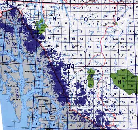
Click on an area of the map below to zoom in on each topo map index.
 Back to the British Columbia Topographic Maps Index.
Each lettered square on the topo map index above represents the following 1:250 000 scale topographic maps: 104A - Bowser Lake, 104B - Iskut River, 104C - Part Of 104B Iskut River, 104F - Sumdum, 104G - Telegraph Creek, 104H - Spatsizi River, 104I - Cry Lake, 104J - Dease Lake, 104K - Tulsequah, 104L - Part Of 104K Tulsequah, 104M - Skagway, 104N - Atlin, 104O - Jennings River, 104P - Mcdame.
Click on the topo map index above to see more detailed maps and information about British Columbia topo maps, including: Spatsizi topo maps and Mount Edziza topo maps.
|
|
|
