QUESTIONS? CALL OR TEXT! 1 (877) 921-6277 or (403) 266-2241
WE SHIP EVERYWHERE!

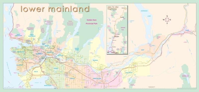
The Lower Mainland Map: Vancouver to Hope & Sea to Sky is a large-format, 24 x 48 inch reference wall map designed for logistics operations, dispatch centers, trip planners, and regional residents across southwestern British Columbia. Delivering a clear, seamless overview of the entire Fraser Valley and surrounding corridors, this comprehensive map connects Metro Vancouver’s urban centers to the eastern gate of Hope and north along the famous Sea to Sky Highway.
End-to-End Metro & Fraser Valley Mapping: Covers all municipalities, rural districts, and communities from Vancouver, Burnaby, and Surrey through Langley, Abbotsford, Mission, Chilliwack, and Hope.
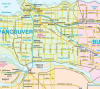
Complete Transportation Infrastructure: Clearly outlines major interprovincial highways (Highway 1 / Trans-Canada, Highway 7, Highway 99), arterial connectors, primary municipal thoroughfares, and key border crossings.
Dedicated Sea to Sky Inset: Features a prominent, highly detailed inset corridor covering the Sea to Sky Highway region, capturing Squamish, Whistler, and Pemberton for easy recreational and travel planning.
Parks & Geographic Features: Highlights major provincial and regional parks, mountain ranges, river systems, lakes, and recreational access points across the Pacific Northwest layout.
Printed in a generous 24 x 48 inch size, this map combines large-scale clarity with stunning visual detail—making it an essential tool for business wall displays, classroom geography studies, and backcountry trip preparation.