QUESTIONS? CALL OR TEXT! 1 (877) 921-6277 or (403) 266-2241
WE SHIP EVERYWHERE!

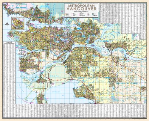
The Metro Vancouver Regional Wall Map is an exceptionally detailed, large-format street map engineered for dispatch centers, urban planners, logistics managers, real estate offices, and local residents across British Columbia's Lower Mainland. Delivering seamless, comprehensive coverage across 17 municipalities, this wall map provides a complete visual layout of the region’s interconnected transportation corridors and civic infrastructure.
This single, large-scale reference map brings together the entire metropolitan region, mapping streets and civic features across:
Vancouver & Core Urban Hubs: Vancouver, North Vancouver, West Vancouver, Burnaby, New Westminster, and Richmond.
South & East Suburbs: Delta, Surrey, White Rock, Langley, and Pitt Meadows.
Tri-Cities & Ridge Meadows: Coquitlam, Port Coquitlam, Port Moody, Maple Ridge, Anmore, and Belcarra.
Precision Street Indexing: Features complete local street networks with clearly marked block numbers for fast, effortless address lookup and route planning.
Community & Emergency Services: Highlights locations for police stations, fire halls, hospitals, public libraries, and elementary, secondary, and private schools.
Recreation & Landmarks: Identifies public parks, golf courses, cemeteries, community and recreation centers, major shopping centers, points of interest, and regional tourist information centers.
Designed for prominent display on office, boardroom, or home walls, the Davenport Metro Vancouver Regional Wall Map offers a clear, large-scale physical perspective of the Lower Mainland that digital devices simply cannot replicate.