QUESTIONS? CALL OR TEXT! 1 (877) 921-6277 or (403) 266-2241
WE SHIP EVERYWHERE!


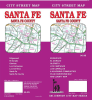
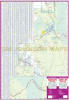
Navigate the historic heart, high-desert mesas, and mountainous terrain of Northern New Mexico with the comprehensive Santa Fe County Street Map. Engineered specifically for residential commuters, real estate professionals, delivery fleets, and Southwest road-trippers, this high-density road map provides an unbroken visual matrix across the entirety of Santa Fe County's sprawling urban and rural networks.
The landscape of Santa Fe County transitions rapidly from the dense, historic plaza streets of the state capital to remote mountain passes, desert foothills, and expanding suburban corridors. Rather than risking dropped signals on cellular networks while driving through remote pinon-covered valleys, this physical street map serves as a highly scannable, permanent navigational safety net.
This map delivers unmatched detail for both high-density urban zones and peripheral master-planned communities. It features complete, localized street coverage for the following key communities and adjoining sectors:
The High-Growth Corridors: Pristine street-level tracking for Edgewood, Eldorado at Santa Fe, and the exclusive enclave of Las Campanas.
Historic Commuter & Rural Hubs: Complete neighborhood grids and arterial road networks for Glorieta and Los Cerrillos.
Downtown Santa Fe Close-Up: A dedicated, large-scale inset of the historic downtown plaza district, specifically designed for effortless on-foot or vehicular navigation past centuries-old adobe buildings, museums, and winding avenues.
Full Santa Fe County Overview: A macro-level regional map tracking major interstate connectors (I-25), state highways, county roads, Pueblo lands, and national forest boundaries.
Alpha-Numeric Street Index: Includes a comprehensive, easy-to-read cross-referenced layout, allowing you to instantly isolate obscure rural lanes, private drives, and suburban avenues.
Point of Interest Directory: High-visibility indicators identify historic missions, state park trailheads, public campgrounds, regional airports, medical facilities, and government hubs.
Topographical & Civil Reference: Tracks county lines, Bureau of Land Management (BLM) acreage, Santa Fe National Forest boundaries, and rail corridors alongside paved and unpaved roads.
| Attribute | Map Directory Profile |
| Coverage Area | Entirety of Santa Fe County, New Mexico |
| High-Resolution Insets | Downtown Santa Fe, Edgewood, Eldorado, Glorieta, Las Campanas, Los Cerrillos |
| Primary Transit Corridors | Interstate 25, US Route 84/285, NM State Road 14 (Turquoise Trail) |
| Key Features Included | Complete street index, public land boundaries, historic landmarks |
| Format | Durable, high-utility fold-out map |