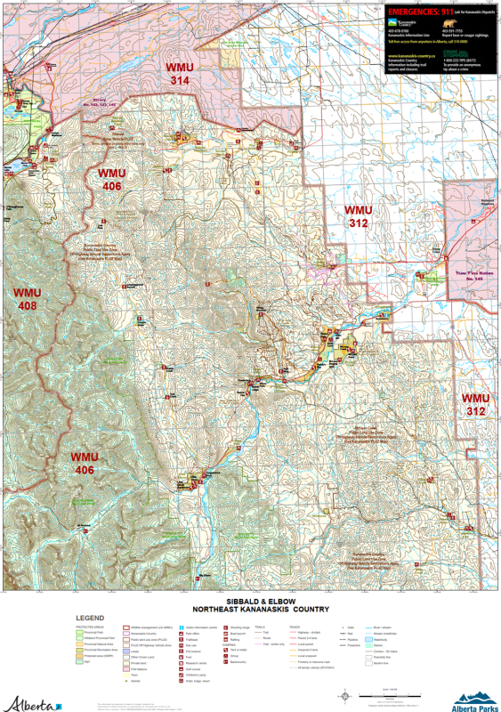
Sibbald & Elbow NE Kananaskis WMU Map. The maps shows the boundary for Kananaskis Country, the Public Land Use Zones, crown land, private or freehold land, park boundaries, wildlife corridors and sanctuaries, camping spots, trailheads, roads, atv trails, hiking trails, forestry roads, rivers, lakes, and other waterways, cities, towns, villages, airports, political boundaries, latitude and longitude grids. This Alberta provincial base map also depicts wildlife management units (WMU's) 312, 314, 406 and 408 and the no hunting zones. Also shows McLean Creek and Tsuu Tina First Nation.