QUESTIONS? CALL OR TEXT! 1 (877) 921-6277 or (403) 266-2241
WE SHIP EVERYWHERE!


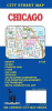
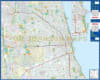
Navigate the "Windy City" and its surrounding metro area with the most comprehensive Chicago, Illinois Road Map. This high-detail street guide provides unmatched coverage of Chicago’s diverse neighborhoods and over 60 adjoining municipalities, making it an essential resource for residents, real estate professionals, and visitors.
Whether you are navigating the grid of the North Side or exploring the suburban reaches of Oak Lawn and Franklin Park, this map offers the precision required for seamless travel across Cook County.
Comprehensive Regional & Transit Features:
Chicagoland Core & Suburbs: Detailed street-level mapping for Chicago, Cicero, Berwyn, Oak Park, Skokie, Des Plaines, and Evanston, extending to southern communities like Blue Island and western hubs like La Grange.
Downtown Enlargement: Features a dedicated, high-scale inset of Downtown Chicago (The Loop), identifying major landmarks, hotels, and the lakefront.
Integrated Rail Navigation: Includes official CTA "L" Train and Metra Commuter Rail maps, allowing for easy coordination between driving and public transit.
Major Transportation Hubs: Clearly marked routes to O'Hare (ORD) and Midway (MDW) International Airports, as well as the intricate interchange system of the Kennedy, Dan Ryan, and Eisenhower Expressways.
Points of Interest: Easily locate the Museum Campus, United Center, Wrigley Field, and the vast Cook County Forest Preserves.