QUESTIONS? CALL OR TEXT! 1 (877) 921-6277 or (403) 266-2241
WE SHIP EVERYWHERE!

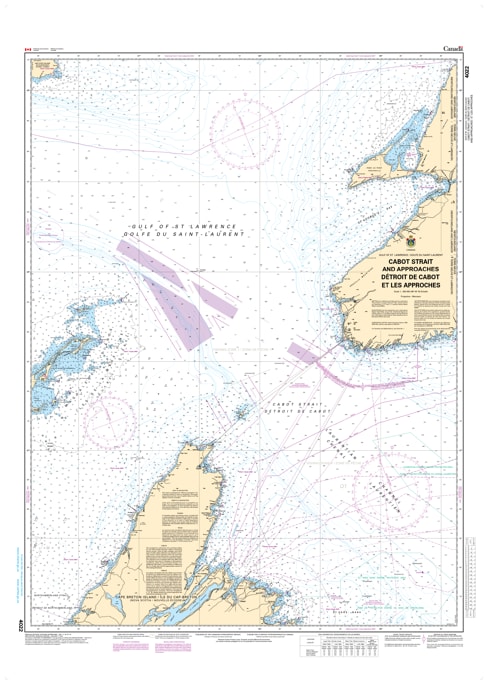
Master the primary gateway to the St. Lawrence Seaway with the Official CHS Chart 4022. This indispensable large-scale chart provides comprehensive coverage of the Cabot Strait (Détroit de Cabot) and its approaches, spanning the critical maritime corridor from Scatarie Island, Nova Scotia, to Ile D'Anticosti, Quebec.
As a genuine Canadian Hydrographic Service (CHS) publication, Chart 4022 is the gold standard for mariners navigating the main entrance to the Gulf of St. Lawrence. This region is a vital artery for international shipping, commercial fishing, and seasonal migrations. Given the strait's reputation for high-traffic density, varying ice conditions, and strong currents, this chart offers the authoritative bathymetry and navigational data required for a safe, professional-grade transit.
Key Features include:
Strategic Wide-Area Coverage: Detailed mapping of the waters between Cape Breton, the southwestern coast of Newfoundland, and the eastern reaches of the Gaspé Peninsula.
Official Data Accuracy: Compiled by the CHS to ensure full compliance with Canadian maritime safety regulations and carriage requirements.
Deep Water & Coastal Detail: Features precise soundings for the Laurentian Channel and the complex approaches to the Magdalen Islands and Anticosti Island.
Navigation & Safety: Includes clearly marked Vessel Traffic Services (VTS) zones, shipping lanes, major coastal lights, and offshore hazards.