QUESTIONS? CALL OR TEXT! 1 (877) 921-6277 or (403) 266-2241
WE SHIP EVERYWHERE!

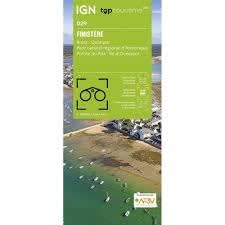


Explore the rugged "Land's End" of France with the IGN Top 100 Finistère Map. Part of the newly revised Top 100 Tourisme series (Map D29), this 1:100,000 scale map is the definitive guide for Department 29. Perfectly balanced for multi-modal travel, it provides the ideal resolution for discovering the jagged Breton coastline and the mysterious interior of the Monts d'Arrée by foot, bike, or car.
This map is a powerhouse for outdoor navigation. For walkers, it features an overprint of the entire GR® 34 (Sentier des Douaniers) coastal path and other long-distance GR® and GR de Pays® routes. Cyclists can navigate with confidence using the enriched secondary road network and official VéloRoutes and Voies Vertes, including sections of the Vélodyssée (EuroVelo 1). The topographic detail is exceptional, featuring contour intervals (ranging from 10m on the coast to 40m in the mountains) and shaded relief. Whether you are visiting the bustling port of Brest, the medieval streets of Quimper, the stunning Pointe du Raz, or the remote Île d'Ouessant, this GPS-compatible, trilingual map ensures every lighthouse, castle, and panoramic viewpoint is easy to find.
Quick Reference: Map Number Guide
New Series Code:D29 (Finistère)
Classic Series Equivalent:Map 106 (Brest / Quimper) and Map 112 (Quimper / Lorient)
Key Coverage: Brest, Quimper, Morlaix, Concarneau, Crozon Peninsula, Parc Naturel Régional d'Armorique, and the Monts d'Arrée.