QUESTIONS? CALL OR TEXT! 1 (877) 921-6277 or (403) 266-2241
WE SHIP EVERYWHERE!

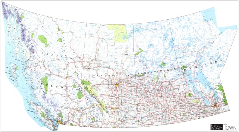
The Western Canada Large Laminated Wall Map is an exceptionally large, high-detail reference map engineered for dispatch centers, corporate boardrooms, logistics hubs, educational institutions, and sales territories across Western Canada. Measuring a massive 55 by 30 inches, this extra-large wall map provides a seamless visual overview across the four western provinces: British Columbia, Alberta, Saskatchewan, and Manitoba.
Complete Provincial Detail: Full geographic coverage sweeping from the Pacific Coast of British Columbia, through the Canadian Rockies of Alberta, across the agricultural plains of Saskatchewan, to the eastern lakes of Manitoba and Hudson Bay.
Transportation & Infrastructure: Clearly outlines major interprovincial highways, primary connecting routes, secondary roads, and extensive rail networks essential for freight tracking, routing, and supply chain planning.
Cities & Municipalities: Displays a comprehensive index of cities, major metro areas, regional towns, rural municipalities, and hamlets with clear, high-visibility labeling.
Topography & Public Lands: Features key physical geography including major lake systems, river basins, provincial parks, national parks, and geographic landmarks across the Canadian West.
Heavy-Duty Lamination: Encapsulated in a tough, crystal-clear laminate coating that protects against tears, spills, and daily office wear.
Dry-Erase Compatible: Allows team members to write directly on the map surface using dry-erase markers—ideal for plotting sales regions, tracking delivery routes, highlighting service zones, and planning travel itineraries.
Whether you are organizing regional business operations, tracking transportation corridors, or outfitting a large wall space with functional geography, the Western Canada XL Wall Map offers an impressive, heavy-duty visual solution.