QUESTIONS? CALL OR TEXT! 1 (877) 921-6277 or (403) 266-2241
WE SHIP EVERYWHERE!


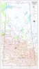

Saskatchewan Provincial Base Map with DLS Grid (Scale 1:1,000,000)
This essential Saskatchewan Provincial Base Map, created by MapTown, provides comprehensive coverage of the entire province, making it ideal for planning, research, and display. At a large format wall map scale of 1:1,000,000, it offers a perfect balance of detail for administrative overview and logistical planning.
Key Features for Professional and Land Use:
Provincial Coverage: This easy-to-read wall map covers all of Saskatchewan, displaying cities, towns, villages, and unincorporated areas.
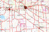
Land Division: Critical for resource management, the map clearly includes the Dominion Land Survey (DLS) grid, showing individual townships and sections.
Geographic Reference: Includes a precise one-degree Geographic Grid (Latitude and Longitude) for easy location referencing and integration with GPS/GIS data.
Infrastructure & Reserves: Clearly marks all primary roads, rivers, lakes, parks, and administrative boundaries, including military reserves and native reserves.
This detailed Saskatchewan DLS Grid Map is an indispensable tool for government offices, corporate logistics, resource sectors, educational institutions, and any organization requiring a complete, high-quality reference map of the province.