QUESTIONS? CALL OR TEXT! 1 (877) 921-6277 or (403) 266-2241
WE SHIP EVERYWHERE!

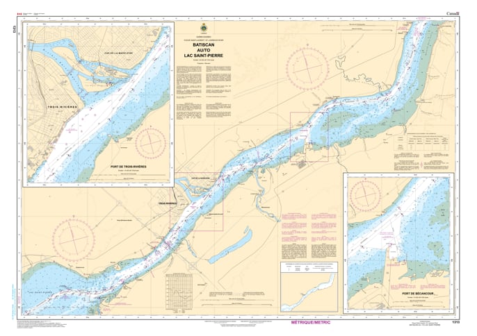
Navigate the central corridor of the St. Lawrence with the 1313 - Batiscan to Lac Saint-Pierre Nautical Chart. This professional-grade hydrographic reference is the definitive guide for one of the river's most active commercial and recreational zones. Covering the waters from the historic shores of Batiscan through the industrial approaches of Trois-Rivières and Bécancour, Chart 1313 provides the high-fidelity "ground-truth" data required for safe passage into the entrance of Lac Saint-Pierre.
Produced to the rigorous standards of the Canadian Hydrographic Service (CHS), Chart 1313 delivers comprehensive information for this busy technical waterway:
Main Shipping Channel Coverage: Features high-resolution depth soundings and bathymetry for the primary commercial channel, including the technical curves and dredged depths essential for deep-draft vessels.
Major Port Approaches: Provides detailed mapping for the Port of Trois-Rivières and the Port of Bécancour, including wharf layouts and industrial waterfront features.
Local Landmarks & Coastal Points: Explicitly marks significant points of interest such as Champlain, Gentilly, and the junction where the Saint-Maurice River meets the St. Lawrence.
Navigational Aids & Signalization: Clearly marks the range lights, lighthouses, and buoy systems necessary for maintaining a safe course amidst the river's shifting currents and high-traffic shipping lanes.
Beyond its functional use on the bridge, this chart serves as a sophisticated piece of maritime history and art for those inspired by the life of the St. Lawrence.
Official Technical Aesthetic: Showcases the intricate line work, sounding density, and maritime symbols used by professional hydrographers.
Vivid Print Quality: Rendered with sharp clarity to ensure every light characteristic, depth contour, and buoy is legible for study or display.
The Perfect Mauricie Gift: An ideal memento for sailors, residents of Trois-Rivières, or anyone with a deep connection to the river's industrial and natural heritage.
| Feature | Details |
| Chart Number | 1313 |
| Location | Batiscan to Lac Saint-Pierre, Quebec |
| Scale | 1:40,000 |
| Key Areas | Trois-Rivières, Bécancour, Champlain, Gentilly |
| Data Type | Hydrographic (Depths, Port Plans, Navigational Aids) |
| Publisher | Canadian Hydrographic Service (CHS) Standards |