QUESTIONS? CALL OR TEXT! 1 (877) 921-6277 or (403) 266-2241
WE SHIP EVERYWHERE!

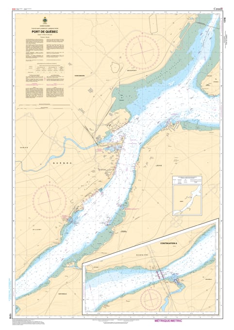
Navigate the historic and busy waters of the St. Lawrence River with the professional precision of the Canadian Hydrographic Service (CHS). Chart 1316 is the essential "road map" for all mariners entering the Port of Québec, a critical hub for international commerce and recreational boating in Canada.
The Port of Québec is renowned for its significant water depth (over 15 meters at low tide) and complex tidal currents. CHS Chart 1316 is specifically designed to meet the rigorous demands of this environment:
Large-Scale Detail: Features a highly detailed 1:15,000 scale, providing the granular data required for maneuvering in intricate harbour areas and dredged channels.
Depth & Bottom Accuracy: Displays precise water depths and the nature of the sea bottom, vital for deep-draft tankers and cruise ships docking at the port's multi-modal terminals.
Navigational Aids & Hazards: Clearly marks all lighthouses, buoys, and markers, as well as underwater hazards and wrecks, ensuring safe passage under the shadow of the Château Frontenac.
Tidal Information: Provides vertical clearances and elevations referred to Higher High Water, essential for navigating the significant tidal range of the St. Lawrence.
Under the Canada Shipping Act, most vessels transiting the St. Lawrence Seaway are required to carry the latest editions of official CHS charts. Whether you are a commercial pilot, a sailing enthusiast from a local yacht club, or an international navigator, Chart 1316 provides the "ground-truth" data needed to prevent incidents in this 24/7 operational port.
| Feature | Details |
| Chart Number | 1316 |
| Region | Quebec (St. Lawrence River) |
| Scale | 1:15,000 (Harbour Chart) |
| Dimensions | 49" x 36" (Standard Paper Size) |
| Vessel Requirement | Certified for carriage aboard commercial vessels |