QUESTIONS? CALL OR TEXT! 1 (877) 921-6277 or (403) 266-2241
WE SHIP EVERYWHERE!

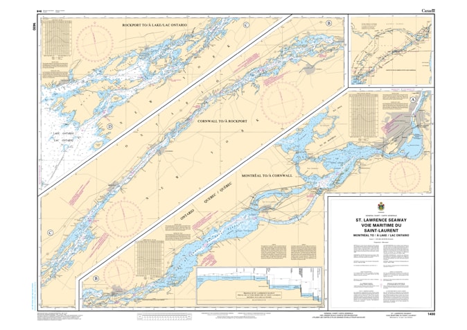
Navigate the backbone of North American maritime commerce with the 1400 - Montreal to Lake Ontario Nautical Chart. This professional-grade hydrographic reference provides a comprehensive overview of the St. Lawrence Seaway, covering the critical transit from the industrial heart of Montreal to the expansive waters of Lake Ontario. Whether you are a commercial pilot managing a "Laker" or a long-distance cruiser heading for the Thousand Islands, Chart 1400 is the indispensable starting point for your voyage.
Produced to the exacting standards of the Canadian Hydrographic Service (CHS), Chart 1400 offers essential "ground-truth" data for inland navigation:
Complete Corridor Overview: Features high-level bathymetry and route data for the entire stretch of the river, including the Lake St. Francis, Lake St. Lawrence, and the narrow passages of the Thousand Islands.
Lock & Infrastructure Reference: Provides critical locations for the Seaway lock system, from Saint-Lambert to Iroquois, ensuring mariners can plan their transit timing accurately.
International Shipping Lanes: Clearly defines the commercial shipping channels used by international vessels, essential for safety and situational awareness in high-traffic zones.
Navigational Aids: Marks major lighthouses, range lights, and buoy systems that guide vessels through the technical turns of the upper river.
Beyond its functional use in the pilothouse, this chart serves as a sophisticated piece of maritime history and art.
Official Technical Aesthetic: Showcases the detailed line work and universal maritime symbols that define professional Canadian hydrography.
Premium Print Clarity: Printed with high-definition precision to ensure every depth contour and navigational aid is sharp and legible for study or display.
The Ultimate Seaway Gift: An ideal memento for sailors, history buffs, or anyone with a home or cottage along the shores of the Upper St. Lawrence.
| Feature | Details |
| Chart Number | 1400 |
| Location | Montreal, QC to Kingston/Lake Ontario, ON |
| Coverage Area | St. Lawrence Seaway, Thousand Islands |
| Data Type | Hydrographic (Overview, Channels, Lock Locations) |
| Publisher | Canadian Hydrographic Service (CHS) Standards |