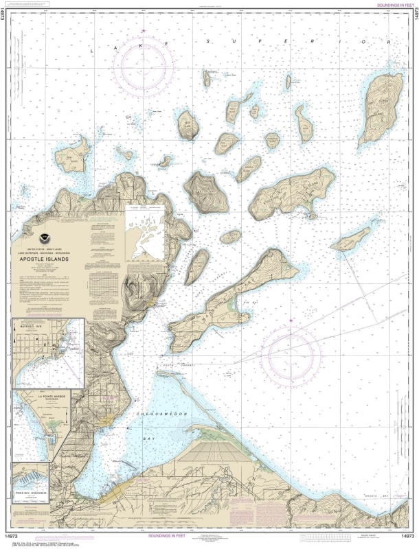
14973 Apostle Islands including Chequamegan Bay - Bayfield Harbor - Pikes Bay Harbor - La Pointe Harbor Historical Nautical Chart
NOAA American Hydrographic Service Charts
$
Choose your options:
Style(optional):
Product Code: 14973
NOAA Chart 14973. Historical Nautical Chart of Apostle Islands including Chequamegan Bay - Bayfield Harbor - Pikes Bay Harbor - La Pointe Harbor. NOAA charts portray water depths, coastlines, dangers, aids to navigation, landmarks, bottom characteristics and other features, as well as regulatory, tide, and other information.
Chart is NOT up-to-date since it is out of continual maintenance
Chart does NOT include all of the latest Notice to Mariners corrections.
The data from which this POD chart is produced is NOT certified by NOAA for navigation use, and is NOT correct to the date of printing
Future Notice to Mariners corrections will NOT be applied to the chart
The product will NOT meet U. S. and international carriage requirements for commercial vessels defined in SOLAS Chapter V Regulation 19.2.1.373
The chart is NOT a U. S. Coast Guard approved product.