QUESTIONS? CALL OR TEXT! 1 (877) 921-6277 or (403) 266-2241
WE SHIP EVERYWHERE!

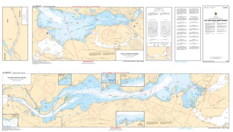
Navigate the scenic crossroads of Quebec’s greatest waterways with the 1510 - Lac des Deux Montagnes Nautical Chart. This professional-grade hydrographic reference is the definitive guide for the expansive waters where the Ottawa River meets the St. Lawrence. Covering the entire reach of the Lake of Two Mountains, Chart 1510 provides the "ground-truth" data required for safe passage between Montreal, Laval, Vaudreuil, and Hudson.
Produced to the rigorous standards of the Canadian Hydrographic Service (CHS), Chart 1510 delivers comprehensive information for this diverse maritime basin:
Sainte-Anne-de-Bellevue & Lock Approaches: Features high-resolution mapping for the critical transit point at the southern tip of the island, essential for navigating the locks and narrow channels.
Oka & Hudson Waterfronts: Detailed bathymetry for the popular beaches of Oka Provincial Park and the historic yachting corridors of Hudson and Vaudreuil-sur-le-Lac.
Major Islands & Hazards: Comprehensive soundings for the waters surrounding Île Bizard and Île Perrot, clearly marking the rocky shoals and sandbars that define the lake’s topography.
Recreational Navigation: Clearly identifies buoyage systems, light characteristics, and public marinas, making it the perfect tool for weekend sailors and long-distance cruisers alike.
Beyond the bridge, this chart serves as a sophisticated piece of maritime history and art for those with a connection to Montérégie or the Laurentians.
Official Technical Aesthetic: Showcases the intricate line work, sounding density, and universal symbols that define professional Canadian hydrography.
Vivid Print Clarity: Printed with high-definition precision to ensure every depth contour and waypoint is sharp and legible for route planning or framing.
The Perfect Gift for Boaters: An ideal memento for anyone who docks at the Royal St. Lawrence Yacht Club or spends summers exploring the Ottawa Valley.
| Feature | Details |
| Chart Number | 1510 |
| Location | Lac des Deux Montagnes (Lake of Two Mountains), QC |
| Scale | 1:20,000 |
| Key Areas | Oka, Hudson, Sainte-Anne-de-Bellevue, Vaudreuil |
| Data Type | Hydrographic (Depths, Lock Approaches, Hazards) |
| Publisher | Canadian Hydrographic Service (CHS) Standards |