QUESTIONS? CALL OR TEXT! 1 (877) 921-6277 or (403) 266-2241
WE SHIP EVERYWHERE!

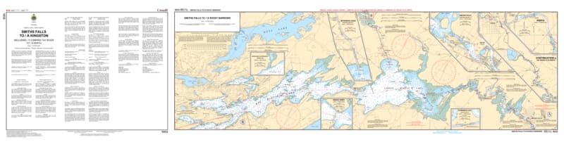


Navigate the scenic southern segment of Canada’s most famous historic waterway with the 1513 - Smiths Falls to/à Kingston Nautical Chart. This professional-grade collection includes five essential maps that provide exhaustive coverage of the Rideau Canal’s southern lakes and the winding Tay River. Whether you are piloting a luxury cruiser through the Big Rideau or paddling into the heart of Perth, this chart set delivers the "ground-truth" data required for a safe and storied journey.
Produced to the rigorous standards of the Canadian Hydrographic Service (CHS), Chart 1513 offers high-resolution detail for every kilometre of the route:
Smiths Falls to the Rideau Lakes: Comprehensive mapping of the channels and lock approaches departing from the regional hub of Smiths Falls.
The Great Lakes of the Rideau: Detailed bathymetry and navigation for Big Rideau Lake, Upper Rideau, and Lower Rideau Lake, featuring safe-water tracks and hazardous shoals.
The Tay Canal & Perth: Exclusive coverage of the Tay River branch, providing the specialized data needed to navigate the narrow channel into historic Perth, Ontario.
The Southern Descent: Detailed soundings for the waterway as it winds through Newboro, Chaffeys Lock, and Jones Falls toward the final approach at Kingston.
Lock & Bridge Data: Clearly marks all vertical and horizontal clearances for bridges and the precise locations of the historic stone locks.
Beyond the wheelhouse, this chart set is a sophisticated record of Canadian engineering and geographic history.
Official Technical Aesthetic: Showcases the intricate line work, sounding density, and specialized inland symbols that define professional hydrography.
Vivid Print Clarity: Printed with high-definition precision to ensure every buoy, depth contour, and light characteristic is sharp and legible for route planning or display.
The Ultimate Rideau Gift: An ideal memento for residents of Rideau Lakes, Kingston, or Perth who celebrate their connection to this world-class waterway.
| Feature | Details |
| Chart Number | 1513 |
| Location | Rideau Canal (Southern Reaches), Tay River |
| Format | Set of 5 Maps |
| Key Areas | Smiths Falls, Perth, Big Rideau Lake, Newboro, Kingston |
| Data Type | Hydrographic (Inland Depths, Locks, Bridge Clearances) |
| Publisher | Canadian Hydrographic Service (CHS) Standards |