QUESTIONS? CALL OR TEXT! 1 (877) 921-6277 or (403) 266-2241
WE SHIP EVERYWHERE!

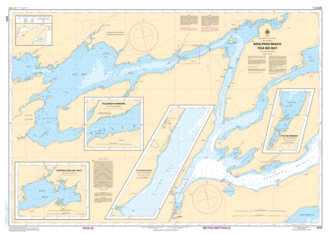
Navigate the heart of Ontario’s most popular sailing and fishing destinations with the professional precision of the Canadian Hydrographic Service (CHS). Chart 2019 is the definitive "road map" for mariners traveling from the deep waters of Adolphus Reach through to Big Bay, covering critical passages near Picton and Deseronto.
The Bay of Quinte is famous for its narrow channels, shifting weed beds, and significant recreational traffic. CHS Chart 2019 is specifically designed to meet these navigational challenges by providing:
High-Detail Bathymetry: Essential for navigating the approach to the Quinte Skyway Bridge and the deep-water port of Picton.
Seabed Characteristics: Identifies the nature of the bottom (mud, rock, or sand), which is vital for secure anchoring in popular spots like Hay Bay or the lee of Thompson Island.
Detailed Shoreline Data: Shows the elevations and configurations of the Prince Edward County coastline, aiding in visual pilotage and identifying landmarks.
Hazards & Aids to Navigation: Clearly marks all lateral buoys, light markers, and underwater obstructions that are critical for avoiding groundings in the bay's shallower reaches.
Whether you are a commercial operator, a professional angler chasing world-class walleye, or a recreational boater exploring the wineries of "The County," Chart 2019 is your primary safety resource. In an era of busy waterways, relying on the official "ground-truth" data of the CHS ensures your vessel and crew remain safe throughout your transit.
| Feature | Details |
| Chart Number | 2019 |
| Region | Bay of Quinte, Lake Ontario (Adolphus Reach to Big Bay) |
| Publisher | Canadian Hydrographic Service (CHS) |
| Key Landmarks | Picton, Deseronto, Quinte Skyway, Thompson Island |
| Scale | Large-scale navigational detail |
| Application | Recreational sailing, commercial shipping, and professional fishing |