QUESTIONS? CALL OR TEXT! 1 (877) 921-6277 or (403) 266-2241
WE SHIP EVERYWHERE!

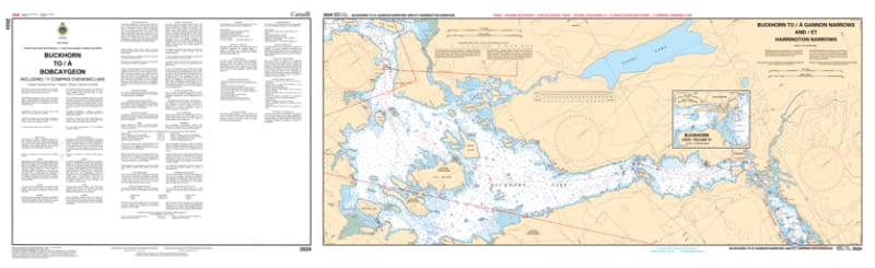
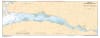
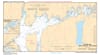
Explore the central artery of the Trent-Severn Waterway with the 2024 - Buckhorn to/à Bobcaygeon including Chemong Lake Nautical Chart set. This professional-grade collection includes five essential maps providing exhaustive coverage of the expansive lake systems that define the region. Whether you are navigating the scenic Gannon Narrows or heading to the famous "Hub of the Kawarthas" at Bobcaygeon, this chart set provides the technical data required for safe and confident passage.
Produced to the rigorous standards of the Canadian Hydrographic Service (CHS), Chart 2024 offers high-resolution detail for this massive freshwater network:
Buckhorn & Pigeon Lakes: Features comprehensive bathymetry for the transit between Lock 31 (Buckhorn) and Lock 32 (Bobcaygeon), identifying safe-water tracks through these weed-heavy and island-dotted basins.
Chemong Lake Extension: Includes detailed mapping of the entire Chemong Lake reach, providing critical soundings for boaters traveling south toward Bridgenorth and Ennismore.
Gannon Narrows & Technical Passes: High-scale detail for the technical bridge crossing and narrows at Gannon, essential for vessels with significant drafts or heights.
Bobcaygeon Approach: Detailed mapping for the approach to the first lock ever built on the system—Lock 32—including docking areas and waterfront depths.
Beyond its navigational utility, this chart set serves as a sophisticated record of the geography of Peterborough County and the City of Kawartha Lakes.
Official Technical Aesthetic: Showcases the intricate line work, sounding density, and specialized symbols that define professional hydrography.
Vivid Print Clarity: Printed with high-definition precision to ensure every buoy, weed bed, and depth contour is sharp and legible for route planning or framing.
The Perfect Gift for the Cottager: An ideal memento for residents of Ennismore, Bridgenorth, Buckhorn, and Bobcaygeon who share a deep connection to these waters.
| Feature | Details |
| Chart Number | 2024 |
| Location | Trent-Severn Waterway (Central Kawarthas) |
| Format | Set of 5 Maps |
| Key Areas | Buckhorn, Bobcaygeon, Chemong Lake, Pigeon Lake, Gannon Narrows |
| Data Type | Hydrographic (Lake Depths, Channel Markers, Lock Clearances) |
| Publisher | Canadian Hydrographic Service (CHS) Standards |