QUESTIONS? CALL OR TEXT! 1 (877) 921-6277 or (403) 266-2241
WE SHIP EVERYWHERE!

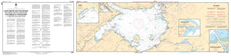


Navigate the vast and vibrant heart of Ontario’s cottage country with the 2028 - Lakes Simcoe & Couchiching including the Holland River Nautical Chart set. This professional-grade collection includes three essential maps that provide exhaustive coverage of the most popular recreational waters in the province. From the deep reaches of Kempenfelt Bay to the intricate channels of the Atherley Narrows, this chart set provides the "ground-truth" data required for safe passage through these expansive basins.
Produced to the rigorous standards of the Canadian Hydrographic Service (CHS), Chart 2028 offers high-resolution detail for both open-water transit and technical river navigation:
Lake Simcoe & Kempenfelt Bay: Features comprehensive bathymetry for the main basin, including the deep-water approaches to Barrie and the sheltered waters of Cook’s Bay.
Lake Couchiching & Orillia: Detailed soundings for the northern transit through Orillia, providing critical information for navigating the shallower, island-dotted waters of Lake Couchiching.
The Holland River & Atherley Narrows: Includes specialized mapping for the southern Holland River approach and the technical, current-prone passage through the Atherley Narrows.
Navigational Hazards: Clearly marks the significant shoals (such as those near Georgina Island), rocky ledges, and summer weed beds that demand careful attention.
Beyond its use on the bridge, this chart set is a sophisticated record of the geography of Simcoe County, York Region, and the City of Kawartha Lakes.
Official Technical Aesthetic: Showcases the intricate line work, sounding density, and specialized symbols that define professional hydrography.
Vivid Print Clarity: Printed with high-definition precision to ensure every buoy, lighthouse, and depth contour is sharp and legible for route planning or office display.
The Perfect Gift for the Waterfront Owner: An ideal memento for residents of Barrie, Orillia, Innisfil, and Beaverton who share a deep connection to the lake.
| Feature | Details |
| Chart Number | 2028 |
| Location | Lake Simcoe, Lake Couchiching, & Holland River |
| Format | Set of 3 Maps |
| Key Areas | Barrie, Orillia, Cook's Bay, Atherley Narrows, Holland Landing |
| Data Type | Hydrographic (Deep-water Bathymetry, Channel Markers, Hazards) |
| Publisher | Canadian Hydrographic Service (CHS) Standards |