QUESTIONS? CALL OR TEXT! 1 (877) 921-6277 or (403) 266-2241
WE SHIP EVERYWHERE!

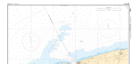
Navigate the historic and technically demanding waters where the Great Lakes meet with the 2043 - Lower Niagara River & Approaches Nautical Chart. This professional-grade hydrographic reference is the essential guide for mariners transiting the border waters of the Niagara River. Whether you are docking at the world-renowned marinas of Niagara-on-the-Lake or navigating the technical currents toward Lewiston and Queenston, Chart 2043 provides the "ground-truth" data required for safe passage.
Produced to the rigorous standards of the Canadian Hydrographic Service (CHS) at a high-resolution 1:20,000 scale, Chart 2043 delivers exhaustive detail for this international corridor:
The River Mouth: Features comprehensive bathymetry for the entrance from Lake Ontario, including the approaches to Fort George (Canada) and Fort Niagara (USA).
Niagara-on-the-Lake & Youngstown: Detailed mapping of the waterfronts of both Niagara-on-the-Lake, ON and Youngstown, NY, featuring accurate soundings for yacht clubs and public wharves.
Upriver Navigation: Provides clear tracking for the channel leading south toward Lewiston, NY and Queenston, ON, identifying the specialized buoyage and landmarks needed to manage river currents.
Navigational Hazards: Clearly marks the shoals at the river mouth and the rocky shorelines that define the Niagara Gorge approaches.
Beyond its use on the bridge, this chart serves as a sophisticated piece of local history for those with a connection to Niagara Region and Western New York.
Official Technical Aesthetic: Showcases the intricate line work, sounding density, and specialized symbols that define professional hydrography.
High-Definition Print: Every depth contour, international boundary line, and shoreline feature is rendered with sharp clarity, making it ideal for route planning or professional display.
The Perfect Gift for the Border Mariner: A must-have for members of the Niagara-on-the-Lake Sailing Club or the Youngstown Yacht Club.
| Feature | Details |
| Chart Number | 2043 |
| Location | Lower Niagara River / Lake Ontario Approaches |
| Scale | 1:20,000 |
| Key Areas | Niagara-on-the-Lake, Youngstown (NY), Lewiston, Queenston |
| Data Type | Hydrographic (River Depths, International Borders, Landmarks) |
| Publisher | Canadian Hydrographic Service (CHS) Standards |