QUESTIONS? CALL OR TEXT! 1 (877) 921-6277 or (403) 266-2241
WE SHIP EVERYWHERE!

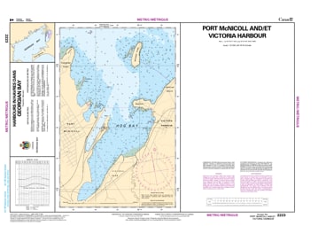
Navigate the historic southern shores of Georgian Bay with the professional precision of the Canadian Hydrographic Service (CHS). Chart 2223 is the definitive "road map" for mariners entering the bustling waterfronts of Port McNicoll and Victoria Harbour. As one of the primary access points to the world-famous 30,000 Islands, these waters demand the high-fidelity detail that only an official CHS chart can provide.
The approach to Victoria Harbour and Hog Bay is characterized by shallow depths and hidden shoals. CHS Chart 2223 is a dedicated Harbour Chart specifically engineered for high-stakes navigation:
Superior 1:15,000 Scale: Offers granular detail for navigating in harbours and intricate, shoal-infested waters where precision is non-negotiable.
Detailed Hydrographic Data: Shows precise water depths and the nature of the sea bottom, essential for deep-draft vessels and recreational yachts docking at the local marinas.
Navigational Hazards & Aids: Clearly marks the lateral buoys, lighted beacons, and underwater dangers that define the safe channels into Hog Bay.
Coastal Characteristics: Features detailed elevations and configuration of the Township of Tay shoreline, aiding in visual pilotage and orientation.
Whether you are a commercial operator, a sailing enthusiast based in Severn Sound, or a weekend explorer visiting the site of the S.S. Keewatin, Chart 2223 is your primary safety tool. In 2026, relying on the official "ground-truth" data of the CHS ensures your vessel and crew remain protected from the ever-shifting hazards of the Great Lakes.