QUESTIONS? CALL OR TEXT! 1 (877) 921-6277 or (403) 266-2241
WE SHIP EVERYWHERE!

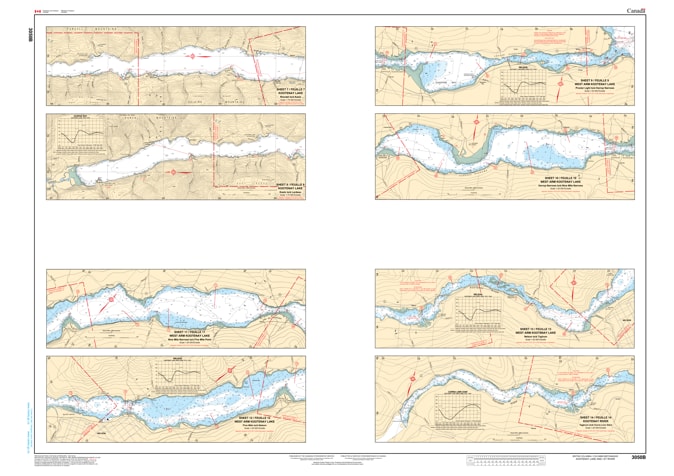


Explore one of British Columbia’s most iconic inland waterways with the professional authority of the Canadian Hydrographic Service (CHS). Chart 3050 is the definitive navigational guide for Kootenay Lake and the Kootenay River, providing comprehensive coverage across a specialized two-sheet set designed for both wide-lake transit and narrow-river precision.
Kootenay Lake is a deep, fjord-type lake known for its spectacular mountain vistas and complex shorelines. CHS Chart 3050 provides the "ground-truth" data required for safe passage:
Strategic West Arm Navigation: Provides high-resolution detail for the West Arm (near Balfour and Nelson), where narrow channels and specific current patterns require precise bathymetric data.
Full Lake Coverage: Includes Sheet 1 and Sheet 2, covering the main body of the lake from Kuskanook and Boswell to the northern reaches near Lardeau.
River & Delta Detail: Offers accurate mapping of the Kootenay River approaches, identifying the shifting shoals and underwater hazards essential for safe transit in shallower areas.
Hazard & Landmark Identification: Clearly marks submerged rocks, navigational aids (buoys and lights), and shoreline elevations, aiding in visual pilotage and safe anchoring in variable depths.
With the increasing popularity of houseboating, sailing, and angling in the Kootenays, the role of Chart 3050 is more vital than ever. Whether you are a local resident, a commercial operator, or a visiting mariner, this official CHS "road map" provides the precision required to show the configuration of the coast, dangers, and aids to navigation.
| Feature | Details |
| Chart Number | 3050 |
| Region | Pacific (BC Interior - Kootenay) |
| Scale | 1:75,000 (Detailed Regional/Harbour Scales) |
| Publisher | Canadian Hydrographic Service (CHS) |
| Format | 2-Sheet Set (Paper or Digital) |
| Key Coverage | Kootenay Lake, Kootenay River, West Arm, Nelson, Balfour |