QUESTIONS? CALL OR TEXT! 1 (877) 921-6277 or (403) 266-2241
WE SHIP EVERYWHERE!

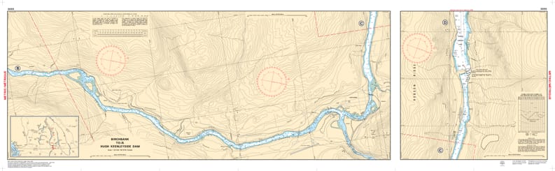

Navigate the powerful currents and scenic reaches of the Upper Columbia River with the professional authority of the Canadian Hydrographic Service (CHS). Chart 3055 is a comprehensive 2-sheet set specifically designed to guide mariners through the vital waterway connecting the international border at Waneta to the Hugh Keenleyside Dam.
River navigation requires a unique level of detail due to shifting channels and significant industrial infrastructure. CHS Chart 3055 provides the "ground-truth" data required for:
High-Resolution River Bathymetry: Features a detailed 1:20,000 scale, providing precise depth soundings and seafloor characteristics—crucial for navigating the river’s varying depths and identifying safe passage near the Trail and Castlegar regions.
Strategic Approach Planning: Offers essential detail for the approaches to major dams and locks, ensuring safe maneuvering for research vessels, commercial tugs, and recreational boaters.
Hazard & Infrastructure Mapping: Explicitly marks submerged dangers, rocky shoals, bridge clearances, and power lines, aiding in safe transit under all visibility conditions.
Nature of the Bottom: Identifies the composition of the riverbed, providing vital information for anchoring or scientific sampling in the sensitive Columbia Basin ecosystem.
With the increasing focus on sustainable ocean and river resources, the role of Chart 3055 is more vital than ever. Whether you are a local angler, a scientific researcher, or a commercial operator, this official CHS "road map" provides the accuracy needed to understand the configuration of the coast, dangers, and aids to navigation on the Columbia.
| Feature | Details |
| Chart Number | 3055 |
| Region | Pacific (Interior BC - Columbia River) |
| Scale | 1:20,000 (Detailed River Scale) |
| Publisher | Canadian Hydrographic Service (CHS) |
| Format | 2-Sheet Set |
| Key Coverage | Waneta, Trail, Castlegar, Hugh Keenleyside Dam |