QUESTIONS? CALL OR TEXT! 1 (877) 921-6277 or (403) 266-2241
WE SHIP EVERYWHERE!

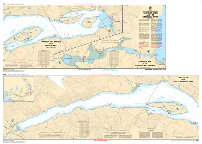
Navigate one of British Columbia's most stunning freshwater systems with the professional accuracy of the Canadian Hydrographic Service (CHS). Chart 3061 is the definitive "road map" for mariners traveling the Harrison River and the expansive waters of Harrison Lake, providing the data necessary to transition from the Fraser River into the wilderness of the Coast Mountains.
The Harrison system is known for its seasonal water level fluctuations and complex river morphology. CHS Chart 3061 is specifically engineered to address these challenges by providing:
Detailed River Bathymetry: Essential for navigating the Harrison River’s shallow stretches and shifting gravel bars, particularly near the confluence with the Fraser.
Deep-Water Lake Soundings: Provides accurate depths for Harrison Lake, which reaches over 270 meters in places—critical for safe anchoring and deep-water sailing.
Submerged Hazards & Obstructions: Clearly identifies "deadheads" (floating logs), rocky shoals, and underwater pinnacles that are common in this glacially-carved fjord.
Coastal Configuration & Elevations: Shows the precise shoreline of Sasquatch Provincial Park and the surrounding mountainous terrain, aiding in visual pilotage.
Whether you are a commercial operator for local forestry, a professional fishing guide, or a recreational boater staying at Harrison Hot Springs, Chart 3061 is your primary safety resource. In an environment where the "Harrison gap" winds can create sudden sea-like conditions, relying on official CHS "ground-truth" data is the only way to ensure a safe journey from port to port.
| Feature | Details |
| Chart Number | 3061 |
| Region | Harrison Lake & Harrison River (British Columbia) |
| Publisher | Canadian Hydrographic Service (CHS) |
| Key Landmarks | Harrison Hot Springs, Echo Island, Sasquatch Provincial Park |
| Scale | Large-scale topographical and hydrographic detail |
| Application | Jet boating, sailing, fishing, and search & rescue operations |