QUESTIONS? CALL OR TEXT! 1 (877) 921-6277 or (403) 266-2241
WE SHIP EVERYWHERE!

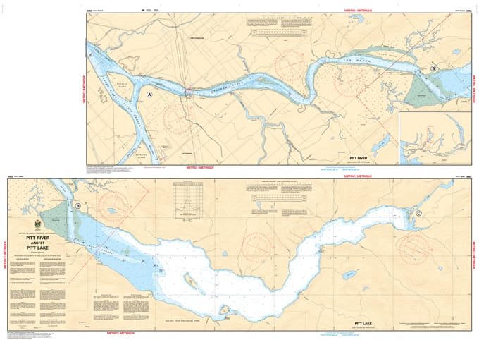
Navigate the scenic and technically demanding waterways of the Lower Mainland with the professional authority of the Canadian Hydrographic Service (CHS). Chart 3062 is the indispensable guide for the Pitt River and Pitt Lake corridor, providing the high-resolution data required to navigate one of the largest tidal freshwater lakes in the world.
The Pitt River is a complex waterway influenced by the tides of the Pacific, requiring accurate data to manage shifting depths and currents. CHS Chart 3062 provides the "ground-truth" data required for:
Large-Scale 1:25,000 Detail: Offers granular mapping for the Lower Pitt River, from its confluence with the Fraser River at Douglas Island up to the southern reaches of Pitt Lake.
Strategic Approach to Pitt Lake: Provides essential bathymetry for the Grant Narrows area, a critical bottleneck for boaters entering the lake's main body.
Hazard & Shoal Identification: Explicitly marks submerged logs, shifting bars, and rocky hazards—vital for safe transit in a river known for its dynamic sedimentation.
Coastal Orientation & Landmarks: Clearly identifies coastal elevations, marshes, and landmarks such as the Alouette River confluence, aiding in visual pilotage and radar orientation.
With increasing recreational boating, kayaking, and fishing activity in the Pitt Meadows and Coquitlam regions, the role of Chart 3052 is more vital than ever. Whether you are a local commercial operator or a weekend explorer heading to Widgeon Creek, this official CHS "road map" provides the precision needed to understand the configuration of the coast, dangers, and aids to navigation.
| Feature | Details |
| Chart Number | 3062 |
| Region | Pacific Coast (Lower Mainland, BC) |
| Scale | 1:25,000 |
| Publisher | Canadian Hydrographic Service (CHS) |
| Key Coverage | Pitt River, Pitt Lake, Douglas Island, Grant Narrows |