QUESTIONS? CALL OR TEXT! 1 (877) 921-6277 or (403) 266-2241
WE SHIP EVERYWHERE!

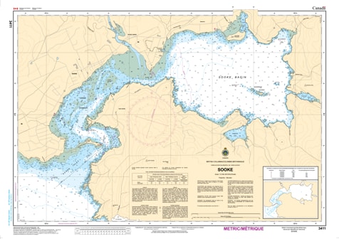
Navigate the intricate waters of Sooke Harbour and Sooke Basin with the professional authority of the Canadian Hydrographic Service (CHS). Chart 3411 is the definitive large-scale guide for this vital South Vancouver Island waterway, providing the extreme detail required to safely transit the famous Whiffin Spit and enter the sheltered reaches of the inner basin.
At a specialized scale of 1:12,000, Chart 3411 offers a level of granular detail that is critical for navigating Sooke’s narrow entries and shifting tidal currents. This CHS "road map" provides the "ground-truth" data required for:
Whiffin Spit & Entrance Safety: Features high-resolution bathymetry for the narrow entrance to Sooke Harbour, where precise positioning is essential to avoid submerged hazards and shoals.
Detailed Basin Bathymetry: Provides accurate depth soundings and seafloor characteristics for Sooke Basin and Roche Cove, essential for safe anchoring and exploring the inner reaches.
Hazard & Obstruction Identification: Clearly marks rocky outcrops, drying banks, and local dangers, ensuring safe passage for recreational fishers, commercial vessels, and visiting cruisers.
Harbour Infrastructure: Includes the configuration of the coast, marina locations, and elevations of prominent landmarks, aiding in visual pilotage and radar orientation in variable weather.
With Sooke’s reputation as a premier destination for world-class fishing and coastal exploration, the role of Chart 3411 is more vital than ever. Whether you are a local mariner, a commercial operator, or a first-time visitor, this official CHS chart provides the precision required to navigate the configuration, dangers, and aids of Sooke’s unique marine environment.
| Feature | Details |
| Chart Number | 3411 |
| Region | Pacific Coast (South Vancouver Island) |
| Scale | 1:12,000 (Detailed Harbour Scale) |
| Publisher | Canadian Hydrographic Service (CHS) |
| Key Coverage | Sooke Harbour, Sooke Basin, Whiffin Spit, Roche Cove |
| Edition Date | 2013-03-15 (Updated with 2026 Notices) |