QUESTIONS? CALL OR TEXT! 1 (877) 921-6277 or (403) 266-2241
WE SHIP EVERYWHERE!

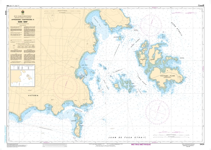
Navigate the beautiful and intricate waters of the South Island with the professional authority of the Canadian Hydrographic Service (CHS). Chart 3424 is the definitive navigational authority for the eastern approaches to Victoria, providing essential high-resolution coverage for Oak Bay, Cadboro Bay, and the strategic passages through the Discovery Island archipelago.
The waters surrounding Oak Bay are famous for their complex tidal currents and hidden rocky outcrops. CHS Chart 3424 provides the "ground-truth" data required for safe passage through these technical waterways:
High-Resolution 1:10,000 Scale: Offers the granular detail necessary for identifying safe leads through Mayor Channel, Baynes Channel, and the narrow Enterprise Channel.
Critical Bathymetry & Currents: Provides accurate depth soundings and seafloor characteristics—essential for mariners dealing with the heavy rips and swirls near the Trial Islands.
Hazard & Shoal Identification: Explicitly marks the dangerous rocks, kelp beds, and submerged hazards common along the Oak Bay coastline, ensuring safe anchoring for recreational boaters and commercial traffic alike.
Aids to Navigation: Clearly identifies the latest positioning of buoys, lights, and beacons, updated with the most recent Notices to Mariners (NOTMAR).
With increasing recreational boating and eco-tourism in the Salish Sea, the role of Chart 3424 is more vital than ever. Whether you are a local sailor out of the Royal Victoria Yacht Club, a kayaker exploring Discovery Island Marine Provincial Park, or a transient vessel rounding the tip of Vancouver Island, this official CHS "road map" provides the accuracy and reliability required for safe navigation.
| Feature | Details |
| Chart Number | 3424 |
| Region | Pacific Coast (South Vancouver Island) |
| Scale | 1:10,000 (Detailed Harbour/Approach Scale) |
| Dimensions | 36" x 48" (Standard Paper Size) |
| Publisher | Canadian Hydrographic Service (CHS) |
| Key Coverage | Oak Bay, Discovery Island, Trial Islands, Cadboro Bay, Baynes Channel |
| Compliance | Meets official carriage requirements for safe marine navigation |