QUESTIONS? CALL OR TEXT! 1 (877) 921-6277 or (403) 266-2241
WE SHIP EVERYWHERE!

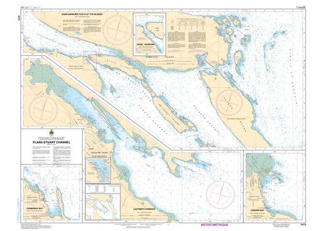
Navigate the heart of the central Gulf Islands with the professional authority of the Canadian Hydrographic Service (CHS). Chart 3475 is the definitive, large-scale "road map" for mariners, providing the granular detail required for entering the major ports of Chemainus and Ladysmith, and transiting the sheltered waters of Stuart Channel.
Stuart Channel is a vital corridor for both commercial shipping and pleasure craft. CHS Chart 3475 provides the "ground-truth" data required for safe coastal pilotage:
Exceptional 1:18,000 Scale: Offers the high-resolution data necessary for identifying safe leads into the Chemainus waterfront and the technical approaches to the Ladysmith harbour.
Island & Anchorage Coverage: Includes detailed mapping for Thetis Island, Kuper (Penelakut) Island, and the popular ferry landing at Preedy Harbour.
Navigation & Safety Markers: Clearly identifies the latest positioning of buoys, lights, and beacons, ensuring safe transit past the rocky shoals and reefs common along the Vancouver Island eastern shore.
Bathymetry & Seafloor Data: Provides accurate depth soundings and seafloor characteristics—essential for vessels anchoring in Dogwood Bay or mooring at local marinas.
With its blend of commercial log booms, international cargo vessels, and a high density of recreational sailboats, the reliability of Chart 3475 is paramount. Whether you are a professional pilot, a commercial fisherman, or a recreational boater exploring the central Gulf Islands, this official CHS chart delivers the accuracy and reliability needed to move from port to port with total confidence.
| Feature | Details |
| Chart Number | 3475 |
| Region | Pacific Coast (Vancouver Island East / Stuart Channel) |
| Scale | 1:18,000 (Detailed Harbour/Plan Scale) |
| Dimensions | 36" x 44" (Standard Paper Size) |
| Publisher | Canadian Hydrographic Service (CHS) |
| Key Coverage | Chemainus, Ladysmith, Thetis Island, Preedy Harbour, Kuper Island |
| Compliance | Meets official carriage requirements for safe marine navigation |