QUESTIONS? CALL OR TEXT! 1 (877) 921-6277 or (403) 266-2241
WE SHIP EVERYWHERE!

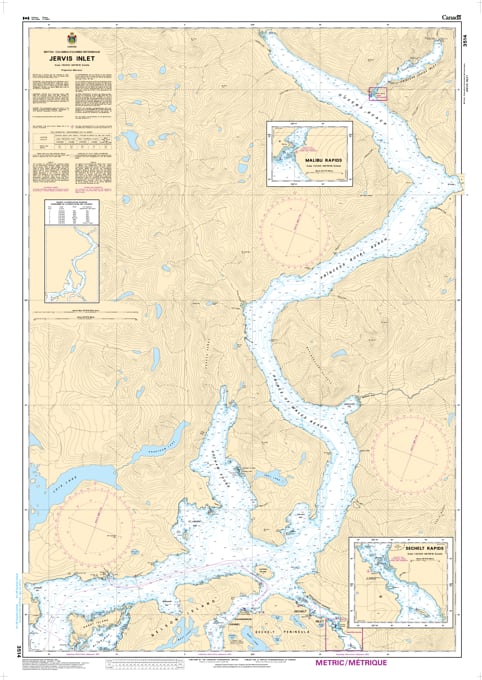
Experience the majesty of the Sunshine Coast’s deepest reaches with the professional authority of the Canadian Hydrographic Service (CHS). Chart 3514 is the essential "road map" for mariners, providing the high-resolution data required for navigating the long, winding waters of Jervis Inlet and its spectacular tributary, Princess Louisa Inlet.
Jervis Inlet is renowned for its sheer mountain walls and extreme depths, but its technical side requires meticulous attention. CHS Chart 3514 provides the "ground-truth" data required for safe pilotage:
Strategic 1:50,000 Scale: Offers a comprehensive view of the entire inlet system, including Princess Royal Reach, Queens Reach, and the technical entry at Malibu Rapids.
Essential Current & Rapid Data: Features critical mapping for the approaches to the Skookumchuck Narrows (Sechelt Rapids) and the narrow entrance to Princess Louisa Inlet, where timing the slack water is vital.
Anchorage & Safe Haven Mapping: Includes detailed bathymetry for Hotham Sound, the Harmony Islands, and various bays along the Sechelt Peninsula, ensuring mariners can find secure shelter from sudden inflow or outflow winds.
Hazard & Shoal Identification: Explicitly marks submerged rocks, shoals, and navigational aids, providing the reliability needed to navigate the rocky fringes of this rugged wilderness.
As the primary reference for one of the most bucket-list-worthy destinations in the Salish Sea, the reliability of Chart 3514 is paramount. Whether you are a professional captain, a local resident, or a recreational boater on a pilgrimage to Chatterbox Falls, this official CHS chart delivers the accuracy and detail needed to navigate these deep-water fjords with total confidence.
| Feature | Details |
| Chart Number | 3514 |
| Region | Pacific Coast (Sunshine Coast / Jervis Inlet) |
| Scale | 1:50,000 (Coastal/Approach Scale) |
| Dimensions | 36" x 49" (Standard Paper Size) |
| Publisher | Canadian Hydrographic Service (CHS) |
| Key Coverage | Jervis Inlet, Princess Louisa Inlet, Hotham Sound, Agamemnon Channel |
| Compliance | Meets official carriage requirements for safe marine navigation |