QUESTIONS? CALL OR TEXT! 1 (877) 921-6277 or (403) 266-2241
WE SHIP EVERYWHERE!

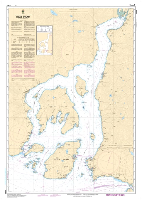
Navigate the breathtaking waters of one of British Columbia’s most iconic fjords with the professional authority of the Canadian Hydrographic Service (CHS). Chart 3526 is the definitive "road map" for mariners, providing the high-resolution 1:40,000 scale data required for navigating the complex channels and island archipelagos of Howe Sound.
Howe Sound is a diverse maritime environment where international shipping, BC Ferries, and recreational sailors converge. CHS Chart 3526 provides the "ground-truth" data required for safe pilotage in these deep, glacier-carved waters:
Comprehensive Sound Coverage: Details the entire fjord system from its mouth at the Strait of Georgia to the industrial port of Squamish at the head of the sound.
Strategic Island Mapping: Features critical bathymetry and shoreline data for Bowen Island, Gambier Island, and Keats Island, ensuring safe passage for cruisers and weekend explorers.
Ferry and Commercial Route Accuracy: Clearly identifies the heavy-traffic zones surrounding the Horseshoe Bay Ferry Terminal and the deep-sea shipping lanes serving the Woodfibre and Squamish terminals.
Hazard & Shoal Identification: Explicitly marks submerged rocks, navigational aids, and the unique underwater topography of the sound, providing the reliability needed to navigate near Anvil Island and the Defence Islands.
With the increasing popularity of eco-tourism and recreational boating along the Sea to Sky corridor, the reliability of Chart 3526 is more vital than ever. Whether you are a professional captain, a commercial fisherman, or a local sailor, this official CHS chart delivers the accuracy and detail needed to navigate from port to port with total confidence.
| Feature | Details |
| Chart Number | 3526 |
| Region | Pacific Coast (Howe Sound / Strait of Georgia) |
| Scale | 1:40,000 |
| Dimensions | 36" x 46" (Standard Paper Size) |
| Publisher | Canadian Hydrographic Service (CHS) |
| Key Coverage | Howe Sound, Squamish, Bowen Island, Gambier Island, Horseshoe Bay |
| Vessel Compliance | Meets official carriage requirements for safe marine navigation |