QUESTIONS? CALL OR TEXT! 1 (877) 921-6277 or (403) 266-2241
WE SHIP EVERYWHERE!

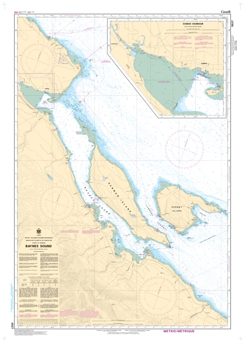
Navigate the protected and ecologically rich waters of the Comox Valley with the professional authority of the Canadian Hydrographic Service (CHS). Chart 3527 is the specialized 1:40,000 scale "road map" for mariners, providing the high-resolution data required for navigating Baynes Sound, a vital 40 km channel and the heart of British Columbia’s shellfish industry.
Baynes Sound is a technical waterway characterized by extensive intertidal flats, shifting shoals, and busy ferry traffic. CHS Chart 3527 provides the "ground-truth" data required for safe passage:
Detailed 1:40,000 Scale: Offers the precision needed to identify safe leads through the sound, avoiding the extensive shoals off Gartley Point, Union Point, and Mapleguard Point.
Essential Harbour & Entry Data: Provides the safest route into Comox Harbour, helping mariners avoid the hazardous Comox Bar by following the clearly marked navigational aids and range lights.
Ferry & Industrial Awareness: Clearly marks the transit route for the Denman Island cable ferry at Buckley Bay, including terminal lights and cable warnings essential for crossing safety.
Bathymetry & Seafloor Characteristics: Includes accurate depth soundings and bottom nature data—crucial for anchoring in Deep Bay, Fanny Bay, or Union Bay, and for vessels operating near the region's dense aquaculture tenures.
As a critical corridor for commercial fishing fleets, recreational cruisers, and the world-renowned oyster industry, the reliability of Chart 3527 is paramount. Whether you are a local resident, a commercial harvester, or a visitor exploring the Southern Strait of Georgia, this official CHS chart delivers the accuracy and detail needed to move from port to port with total confidence.
| Feature | Details |
| Chart Number | 3527 |
| Region | Pacific Coast (Vancouver Island East) |
| Scale | 1:40,000 (Detailed Coastal Scale) |
| Dimensions | 36" x 49" (Standard Paper Size) |
| Publisher | Canadian Hydrographic Service (CHS) |
| Key Coverage | Baynes Sound, Comox Harbour, Denman Island, Deep Bay, Buckley Bay |
| Compliance | Meets official carriage requirements for safe marine navigation |