QUESTIONS? CALL OR TEXT! 1 (877) 921-6277 or (403) 266-2241
WE SHIP EVERYWHERE!

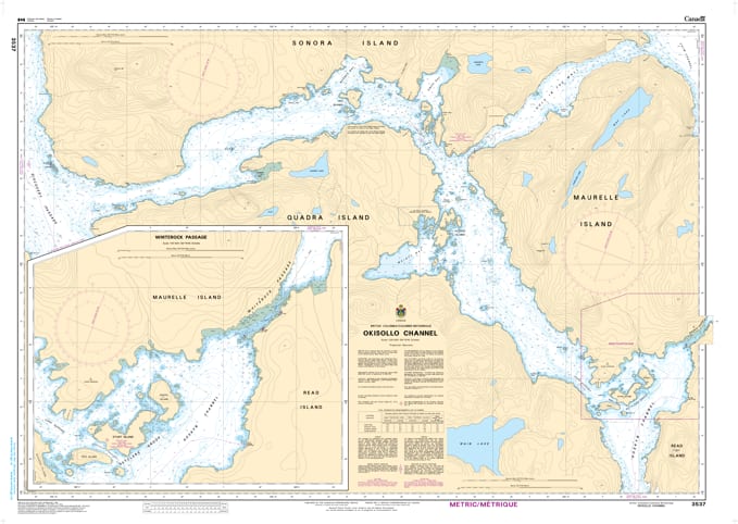
Navigate the powerful tidal currents and intricate passages of the Discovery Islands with the professional authority of the Canadian Hydrographic Service (CHS). Chart 3537 is the definitive 1:20,000 "road map" for mariners, providing the granular detail required for navigating Okisollo Channel, one of British Columbia’s most technical and rewarding coastal waterways.
Okisollo Channel is famous for its "Rapids"—where tidal streams can reach extreme velocities. CHS Chart 3537 provides the "ground-truth" data required for safe passage:
Exceptional 1:20,000 Scale: Offers the high-resolution data necessary for identifying safe leads through the Upper and Lower Okisollo Rapids and the tight confines of Beazley Passage.
Discovery Island Connectivity: Provides detailed bathymetry for the waters separating Quadra Island and Sonora Island, including the popular but technical Hole in the Wall and Surge Narrows areas.
Essential Current & Hazard Awareness: Explicitly marks submerged rocks, overfalls, and eddies, which are vital for mariners timing their transit with slack water.
Detailed Shoreline and Elevations: Includes accurate configuration and characteristics of the coast, helping mariners identify landmarks in these narrow, forested channels.
With the increasing popularity of recreational cruising and eco-tourism in the Discovery Islands, the reliability of Chart 3537 is paramount. Whether you are a local tug operator, a commercial fisherman, or a recreational boater exploring the hidden reaches of the North Coast, this official CHS chart delivers the accuracy and detail needed to navigate these technical waters with total confidence.
| Feature | Details |
| Chart Number | 3537 |
| Region | Pacific Coast (Discovery Islands / Johnstone Strait) |
| Scale | 1:20,000 (Detailed Passage Scale) |
| Dimensions | 33" x 47" (Standard Paper Size) |
| Publisher | Canadian Hydrographic Service (CHS) |
| Key Coverage | Okisollo Channel, Quadra Island, Sonora Island, Upper/Lower Rapids |
| Compliance | Meets official carriage requirements for safe marine navigation |