QUESTIONS? CALL OR TEXT! 1 (877) 921-6277 or (403) 266-2241
WE SHIP EVERYWHERE!

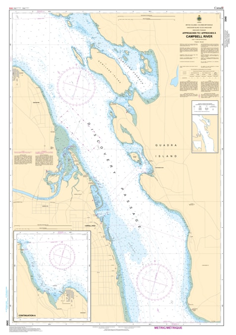
Navigate the gateway to the North Coast with the professional authority of the Canadian Hydrographic Service (CHS). Chart 3540 is the essential, large-scale "road map" for mariners, providing the granular 1:10,000 detail required for safe transit through the busy waters of Campbell River and the industrial terminal at Duncan Bay.
As a major hub for recreational fishing, commercial shipping, and ferry traffic, the approaches to Campbell River demand extreme navigational accuracy. CHS Chart 3540 provides the "ground-truth" data needed for safe coastal pilotage and docking:
High-Resolution 1:10,000 Scale: Offers the detailed bathymetry necessary for identifying safe leads into Campbell River Harbour and the technical approaches to Discovery Passage.
Strategic Industrial Coverage: Features precise mapping for the commercial berths at Duncan Bay, essential for deep-sea vessels and tug operations serving regional industry.
Essential Marine Infrastructure: Clearly identifies ferry terminals, marinas, breakwaters, and the latest positioning of navigational aids, ensuring situational awareness in high-traffic zones.
Hazard & Shoal Identification: Explicitly marks submerged rocks, shifting seafloor characteristics, and elevations near the coastline, helping mariners avoid dangerous waters in this high-current region.
With the convergence of heavy recreational boating, commercial fishing, and international shipping, the reliability of Chart 3540 is more vital than ever. Whether you are a professional pilot guiding a vessel toward the Seymour Narrows or a recreational angler exploring the "Salmon Capital of the World," this official CHS chart delivers the accuracy and detail needed to navigate with total confidence.
| Feature | Details |
| Chart Number | 3540 |
| Region | Pacific Coast (Vancouver Island East) |
| Scale | 1:10,000 (High-Resolution Harbour Scale) |
| Dimensions | 36" x 49" (Standard Paper Size) |
| Publisher | Canadian Hydrographic Service (CHS) |
| Key Coverage | Campbell River Harbour, Duncan Bay, Discovery Passage Entrance |
| Compliance | Meets official carriage requirements for safe marine navigation |