QUESTIONS? CALL OR TEXT! 1 (877) 921-6277 or (403) 266-2241
WE SHIP EVERYWHERE!

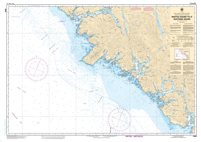
Navigate the remote and majestic frontier of Vancouver Island’s outer coast with the professional authority of the Canadian Hydrographic Service (CHS). Chart 3604 is the definitive 1:150,000 scale "road map" for mariners, providing the extensive offshore coverage and vital inshore detail required for safe transit between the historic Nootka Sound and the northern gateway of Quatsino Sound.
The stretch between Nootka and Quatsino is home to some of the most dramatic and weather-exposed features on the BC coast, including the legendary Brooks Peninsula. CHS Chart 3604 provides the "ground-truth" data required for safe pilotage:
Strategic Coastal Coverage: Offers the necessary resolution to navigate the open Pacific while transitioning between the deep-water fjords of Esperanza Inlet, Kyuquot Sound, and Quatsino Sound.
Brooks Peninsula & Cape Cook: Provides critical bathymetry for rounding the Brooks Peninsula, an area known for distinct weather patterns and intense sea states where situational awareness is paramount.
Remote Sound Connectivity: Detailed data for the approaches to Checleset Bay and the intricate coastal reefs, essential for commercial fishing fleets and long-range cruisers seeking shelter.
Hazard & Seafloor Identification: Explicitly marks submerged rocks, shoals, and seafloor characteristics, allowing mariners to identify safe havens and avoid the rugged dangers of this untamed coastline.
As the primary link for vessels transiting between Friendly Cove and Winter Harbour, the reliability of Chart 3604 is more vital than ever. Whether you are a professional captain managing a Pacific crossing or a recreational explorer venturing into the Great Bear Rainforest transition, this official CHS chart delivers the accuracy and detail needed to navigate with total confidence.
| Feature | Details |
| Chart Number | 3604 |
| Region | Pacific Coast (Vancouver Island North-West) |
| Scale | 1:150,000 |
| Dimensions | 36" x 48" (Standard Paper Size) |
| Publisher | Canadian Hydrographic Service (CHS) |
| Key Coverage | Nootka Sound, Kyuquot Sound, Quatsino Sound, Brooks Peninsula, Esperanza Inlet |
| Compliance | Meets official carriage requirements for safe marine navigation |