QUESTIONS? CALL OR TEXT! 1 (877) 921-6277 or (403) 266-2241
WE SHIP EVERYWHERE!

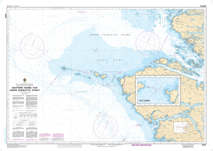
Round the northern tip of Vancouver Island with the professional authority of the Canadian Hydrographic Service (CHS). Chart 3605 is the definitive 1:150,000 scale "road map" for mariners, providing the extensive offshore coverage and vital inshore detail required for safe transit between Quatsino Sound and the western entrance of Queen Charlotte Strait.
The waters surrounding Cape Scott are among the most dynamic on the British Columbia coast, where Pacific swells meet the tidal currents of the Inside Passage. CHS Chart 3605 provides the "ground-truth" data required for safe pilotage:
Strategic Rounding Data: Offers the necessary resolution for navigating the infamous waters of Cape Scott, identifying safe routes through the Scott Channel and around the Scott Islands.
Essential Entrance Detail: Provides the bathymetry and shoreline configuration needed to make safe entries into Quatsino Sound, Winter Harbour, and Forward Inlet.
Inside Passage Gateway: Detailed mapping for the western approaches to Goletas Channel and Hope Island, serving as the primary link for vessels moving from the open ocean to sheltered channels.
Hazard & Seafloor Identification: Explicitly marks submerged reefs, shoals, and seafloor characteristics, which are vital for identifying emergency anchorages like Sea Otter Cove or avoiding the rugged dangers of the North Coast.
As the primary link for vessels transiting between the remote sounds of the West Coast and the bustling marine corridors of Port Hardy, the reliability of Chart 3605 is paramount. Whether you are a commercial captain managing a northern transit or a recreational explorer seeking the wild beauty of Cape Scott Provincial Park, this official CHS chart delivers the accuracy and detail needed to navigate with total confidence.
| Feature | Details |
| Chart Number | 3605 |
| Region | Pacific Coast (North Vancouver Island / Cape Scott) |
| Scale | 1:150,000 |
| Dimensions | 36" x 48" (Standard Paper Size) |
| Publisher | Canadian Hydrographic Service (CHS) |
| Key Coverage | Quatsino Sound, Cape Scott, Scott Islands, Queen Charlotte Strait |
| Compliance | Meets official carriage requirements for safe marine navigation |