QUESTIONS? CALL OR TEXT! 1 (877) 921-6277 or (403) 266-2241
WE SHIP EVERYWHERE!

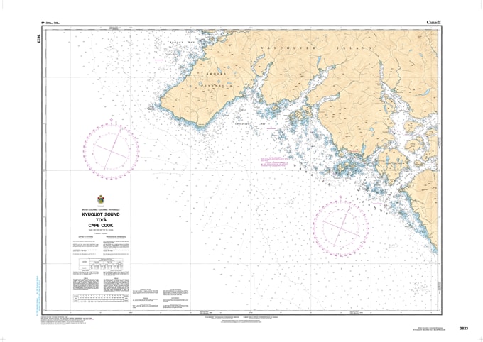
Navigate the untamed "Graveyard of the Pacific" with the professional authority of the Canadian Hydrographic Service (CHS). Chart 3623 is an essential 1:80,000 scale "road map" for mariners, providing the high-resolution data required for safe passage between the secluded inlets of Kyuquot Sound and the exposed headlands of Cape Cook.
The waters surrounding the Brooks Peninsula are notorious for intense sea states and rapid weather changes. CHS Chart 3623 provides the "ground-truth" data required for safe pilotage in this high-energy environment:
Rounding Cape Cook: Features the critical bathymetry needed to navigate the waters around the Brooks Peninsula and the wildlife-rich Solander Island, where situational awareness is paramount for avoiding submerged hazards.
Kyuquot Sound Detail: Provides the precision mapping necessary for identifying safe leads into the Mission Group islands and the technical entrances of Kyuquot Sound.
Checleset Bay Coverage: Includes detailed data for Checleset Bay and the Barrier Islands, offering mariners the information needed to seek shelter or navigate through complex rocky reefs.
Essential Coastal Data: Explicitly marks submerged rocks, shoals, tidal information, and sea bottom characteristics, providing the reliability needed for secure anchoring in remote northwestern bays.
As the primary reference for vessels transiting the northwestern coast of Vancouver Island, the reliability of Chart 3623 is more vital than ever. Whether you are a commercial fisher timing a crossing of the peninsula or a recreational explorer venturing into the Checleset Bay Ecological Reserve, this official CHS chart delivers the accuracy and detail needed to navigate with total confidence.
| Feature | Details |
| Chart Number | 3623 |
| Region | Pacific Coast (Vancouver Island North-West) |
| Scale | 1:80,000 |
| Dimensions | 36" x 48" (Standard Paper Size) |
| Publisher | Canadian Hydrographic Service (CHS) |
| Key Coverage | Kyuquot Sound, Cape Cook, Brooks Peninsula, Solander Island, Checleset Bay |
| Compliance | Meets official carriage requirements for safe marine navigation |